
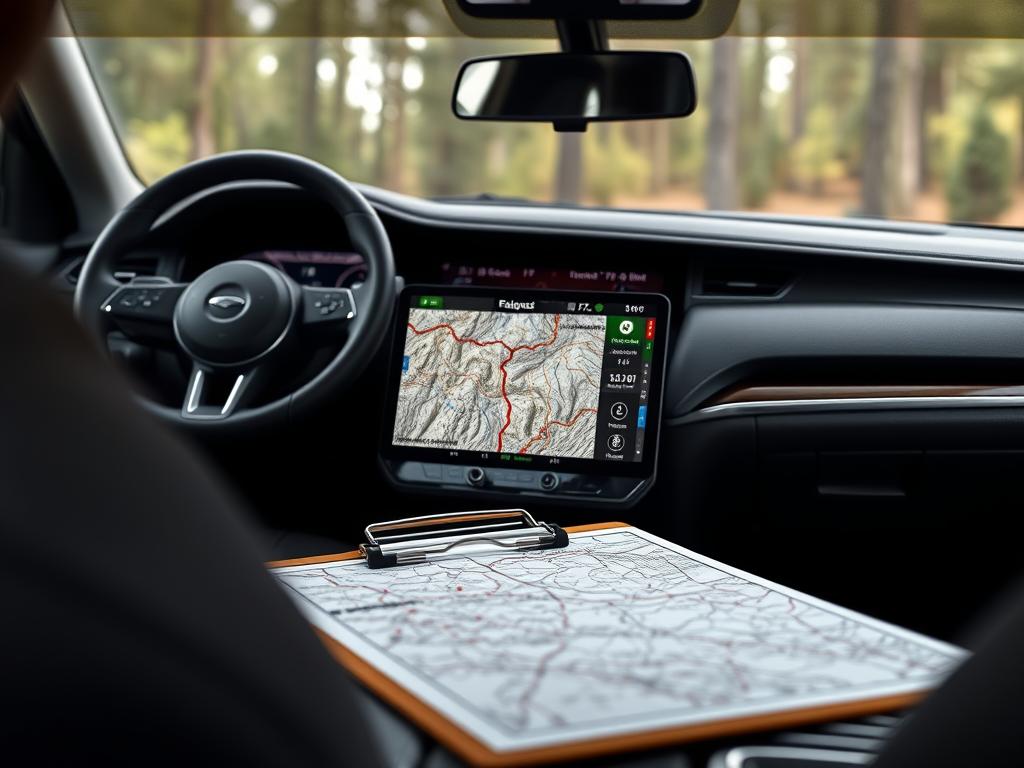
Navigating the great outdoors requires a blend of traditional skills and modern technology. Both electronic navigational tools and paper maps have their unique advantages and limitations. By integrating these resources, adventurers enhance their experience in area selection, route and camp planning, and navigating enroute.
Area Selection
Selecting an area for exploration is a critical first step in any outdoor adventure. This process involves evaluating potential destinations based on various factors such as terrain, accessibility, points of interest, and environmental conditions. Both electronic navigational tools and paper maps play pivotal roles in this stage, each offering unique benefits that complement the other.
Advantages of Electronic Navigational Tools
Electronic navigational tools have revolutionized the way adventurers select areas for exploration. GPS devices, Google Earth, and CalTopo, as well as mapping applications like AllTrails, TrailsOffroad, or FunTreks provide users with access to a wealth of information at their fingertips. These tools offer several key advantages:
- Detailed Satellite Imagery: Satellite images provide a bird’s-eye view of the landscape, allowing users to assess terrain features such as mountains, valleys, rivers, and forests. This visual information helps in identifying potential challenges and opportunities within the area.
- Topographical Data: Digital maps often include detailed topographical information, such as contour lines and elevation data. This allows users to evaluate the difficulty of the terrain and plan accordingly.
- Zoom and Pan Capabilities: Users can zoom in on specific regions to examine details or zoom out for a broader view. This flexibility aids in understanding the spatial relationships between different features and planning routes that maximize safety and enjoyment.
- Overlaying Data Sets: Many electronic tools allow users to overlay additional data sets, such as weather patterns, land use, or wildlife habitats. This capability provides a comprehensive understanding of the area, helping users make informed decisions about when and where to explore.
- Real-Time Updates: Electronic tools can provide real-time updates on conditions such as weather changes, trail closures, or natural hazards. This dynamic information is crucial for adapting plans and ensuring safety.
The Enduring Value of Paper Maps
Despite the technological advancements of electronic tools, paper maps remain an invaluable resource in area selection. They offer several distinct advantages:
- Broad Perspective: Paper maps provide a wide-angle view of a region, helping users to see the big picture. This perspective is essential for understanding the overall layout of the land and identifying connections between different areas.
- Historical and Cultural Information: Many paper maps include historical and cultural details that digital maps might overlook. This information can enrich the exploration experience by highlighting significant landmarks, historical sites, or culturally important areas.
- Reliability: Paper maps do not rely on battery life, internet connectivity, or satellite signals. This makes them a reliable backup in remote areas where electronic devices might fail.
- Skill Development: Using paper maps encourages the development of traditional navigation skills, such as interpreting map symbols, understanding scales, and using a compass. These skills are invaluable for making informed decisions and adapting plans when necessary.
- Deliberate Planning: The manual process of using a paper map fosters a more deliberate and thoughtful approach to area selection. Users must engage with the map actively, which can lead to a deeper understanding of the terrain and a more meaningful connection to the environment.
The process of area selection benefits greatly from the integration of both electronic navigational tools and paper maps. While electronic tools offer precision, convenience, and real-time data, paper maps provide reliability, a broader perspective, and the development of essential navigation skills. By leveraging the strengths of both resources, adventurers can make informed decisions, enhance their safety, and enrich their exploration experience.
Route and Camp Planning
Effective route and camp planning are key for a successful outdoor adventure. This process involves determining the best paths to follow, identifying suitable camping locations, and preparing for potential challenges along the way. Both electronic navigational tools and paper maps offer distinct advantages that, when combined, provide a comprehensive approach to planning.
Advantages of Electronic Navigational Tools
Electronic tools have transformed route and camp planning by offering precision, convenience, and real-time data. Here are some of the key benefits:
- Precision in Calculations: GPS devices and mapping apps can accurately calculate distances, elevation changes, and estimated travel times. This precision helps adventurers plan their days effectively, ensuring they have enough time and resources to reach their destinations safely.
- 3D Visualization: Many electronic tools offer three-dimensional views of the terrain, which is particularly useful in mountainous or complex landscapes. This feature allows users to visualize the route’s elevation profile and anticipate challenging sections, such as steep ascents or descents.
- Waypoint Plotting: Users can plot waypoints along their route, marking important locations such as water sources, scenic viewpoints, or potential hazards. This capability aids in navigation and ensures that critical points are not overlooked.
- Multiple Route Options: Electronic tools can store multiple route options, allowing adventurers to compare different paths and choose the one that best suits their preferences and abilities. This flexibility is valuable for adapting plans based on changing conditions or personal preferences.
- Real-Time Updates: Access to real-time updates on trail conditions, weather alerts, or closures is a significant advantage of electronic tools. This information allows adventurers to make informed decisions and adjust their plans to ensure safety and success.
The Enduring Value of Paper Maps
Despite the technological advancements of electronic tools, paper maps remain a crucial component of route and camp planning. They offer several distinct advantages:
- Tangible Overview: Paper maps provide a physical representation of the entire journey, allowing adventurers to see the big picture. This overview helps in understanding the spatial relationships between different parts of the route and making connections that might not be immediately apparent on a screen.
- Skill Development: Using paper maps encourages the development of traditional navigation skills, such as interpreting contour lines, understanding map scales, and using a compass. These skills are invaluable for adapting plans on the fly, especially in areas where electronic devices might fail.
- Reliability: Paper maps do not rely on batteries, internet connectivity, or satellite signals, making them a reliable backup in remote areas. They ensure that adventurers can continue their journey even if electronic devices malfunction or run out of power.
- Engagement with the Environment: The manual process of using a paper map fosters a deeper engagement with the environment. Adventurers must actively interpret the map and relate it to the physical landscape, leading to a more immersive and rewarding experience.
- Backup and Redundancy: Having a paper map as a backup provides redundancy, which is a critical component of risk management in outdoor adventures. It ensures that adventurers have an alternative navigation method if electronic tools become unavailable.
Integration both electronic navigational tools and paper maps enhances route and camp planning: Electronic tools offer precision, convenience, and real-time data, while paper maps provide reliability, a broader perspective, and the development of essential navigation skills. By leveraging the strengths of both resources, adventurers can plan effectively, enhance their safety, and enrich their outdoor experience.
Navigating Enroute
Navigating enroute is a dynamic and critical aspect of any outdoor adventure. It involves maintaining the planned course, adapting to unforeseen challenges, and ensuring safety throughout the journey. Both electronic navigational tools and paper maps play vital roles in this process, each offering unique benefits that enhance the overall navigation experience.
Advantages of Electronic Navigational Tools
Electronic navigational tools have significantly enhanced the ability to navigate enroute by providing real-time guidance and tracking. Here are some of the key advantages:
- Real-Time Location Tracking: GPS devices and smartphone apps1 for an in-depth explanation on why I prefer dedicated GPS devices over smartphone apps for navigation… can pinpoint a user’s exact location on a map, providing a clear understanding of their current position relative to the planned route. This capability is invaluable in unfamiliar terrain or poor visibility conditions, such as fog or dense forest.
- Turn-by-Turn Directions: Many electronic tools offer turn-by-turn directions, guiding adventurers along the planned path with precision. This feature reduces the likelihood of taking wrong turns and helps maintain the intended course.
- Progress Tracking: Electronic tools can track progress against planned routes, providing updates on distance traveled, estimated time of arrival, and remaining distance. This information helps adventurers manage their pace and make informed decisions about rest stops or adjustments to the itinerary.
- Location Sharing: Many devices allow users to share their location data with others, enhancing safety by enabling easy coordination with team members or emergency services. This feature is particularly useful in group expeditions or in case of emergencies.
- Adaptability: Electronic tools can quickly adapt to changes in the environment, such as trail closures or weather conditions, by providing alternative routes or alerts. This adaptability is crucial for maintaining safety and flexibility during the journey.
The Enduring Value of Paper Maps
Despite the advantages of electronic tools, relying solely on them can be risky. Paper maps serve as an essential backup and offer several distinct benefits:
- Reliability: Paper maps do not depend on batteries, internet connectivity, or satellite signals, making them a reliable backup in remote areas where electronic devices might fail. They ensure that adventurers can continue navigating even if technology becomes unavailable.
- Manual Navigation Skills: Using paper maps encourages the development and use of traditional navigation skills, such as identifying landmarks, taking compass bearings, and interpreting contour lines. These skills are invaluable for navigating in areas where electronic tools might be less effective.
- Engagement with the Environment: Navigating with a paper map fosters a deeper connection with the environment. Adventurers must actively engage with the landscape, using natural features to guide their way. This process can be more rewarding and immersive than relying solely on digital guidance.
- Backup and Redundancy: Having a paper map as a backup provides redundancy, which is a critical component of risk management in outdoor adventures. It ensures that adventurers have an alternative navigation method if electronic tools become unavailable.
- Tactile Experience: The tactile experience of handling a paper map can enhance the sense of adventure and exploration. It encourages a more deliberate and thoughtful approach to navigation, promoting a deeper appreciation for the journey.
Navigating enroute benefits greatly from the integration of both electronic navigational tools and paper maps. Electronic tools offer real-time guidance, precision, and adaptability, while paper maps provide reliability, skill development, and a deeper connection with the environment. By leveraging the strengths of both resources, adventurers can navigate effectively, ensure safety, and enrich their outdoor experience.
Conclusion
In conclusion, the integration of modern electronic navigational tools and traditional paper maps provides a comprehensive approach to outdoor navigation. Electronic tools offer precision, convenience, and real-time data, while paper maps provide reliability, a broader perspective, and the development of essential navigation skills. By using both resources, adventurers can enhance their experience, ensure safety, and foster a deeper appreciation for the landscapes they explore.
- Check out my essay Maximize Your Adventure with Caltopo: Mapping Tools Explained ↩︎


Leave a Reply