
NOTE: In the below essay, I am not going into any detail about using mapping software on a mobile device, even though many folks today are using GaiaGPS and/or OnX as their primary means of navigation when on the move – I do not. I use a Garmin GPSMAP 67i when I am hiking, and a Garmin Overlander in the Jeep instead (to see my reasoning, cf. Dedicated vs. Mobile Device.)
“For the record,” while GaiaGPS and OnX seem to be the most hyped by Youtube pundits, Caltopo is, in my opinion far superior to both – and my reasons are outlined below. That said, CalTopo has mobile navigation capabilities with offline maps, etc. as well; just like the other two. So, for those who insist on trusting their navigational well-being to a mobile device, Caltopo is definitely a viable alternative!
Also, I primarily use “SARtopo,” which is essentially identical to Caltopo, but does have some features geared specifically towards S&R. For full disclosure, I am supporting the Caltopo team with a PRO subscription, paid out of my own pocket, not sponsored. I just love the capabilities…
Lastly, I do subscribe to AllTrails (Pro) and TrailsOffroad as well, but use those primarily as tools to find and download trails (.gpx format) for upload into CalTopo.
When it comes to trip planning, especially for outdoor adventures like overlanding, hiking, backpacking, or mountaineering, having the right tools can make all the difference. Among the various mapping and navigation tools available, Caltopo stands out as my preferred choice over GaiaGPS and OnX. This preference is rooted in several key features and functionalities that Caltopo offers, which align perfectly with my needs for detailed planning, customization, and reliability.
Map Customization
Caltopo’s ability to provide highly detailed and customizable maps is one of its standout features, setting it apart from other mapping tools like GaiaGPS and OnX. This capability is crucial for outdoor enthusiasts who require a comprehensive understanding of the terrain they will be navigating. Let’s delve deeper into the specific aspects that make Caltopo’s map customization so effective.
Layering Different Types of Maps
Caltopo allows users to layer various types of maps, such as topographic, satellite, and terrain maps, to create a multi-dimensional view of the area. This layering capability is particularly beneficial for several reasons:
- Topographic Maps: These maps provide detailed information about the elevation and contour lines of the terrain. By understanding the topography, users can identify steep areas, valleys, and ridges, which are essential for route planning and assessing the difficulty of a hike or climb.
- Satellite Maps: Satellite imagery offers a real-world view of the landscape, showing vegetation, water bodies, and man-made structures. This visual information helps users verify the presence of trails, roads, and other features that may not be apparent on topographic maps alone.
- Terrain Maps: These maps highlight the physical features of the landscape, such as mountains, hills, and flat areas. By combining terrain maps with topographic and satellite maps, users gain a comprehensive understanding of the environment, aiding in the identification of potential hazards and safe passageways.
Customizable Overlays
Caltopo’s ability to add customizable overlays further enhances its utility for trip planning. Some of the most valuable overlays include:
- Slope Angle Shading: This overlay uses color gradients to indicate the steepness of the terrain. It is particularly useful for backcountry skiing, mountaineering, and avalanche risk assessment, as it helps users identify areas that may be prone to avalanches or are too steep for safe travel.
- Land Management Boundaries: This overlay shows the boundaries of different land management areas, such as national parks, wilderness areas, and private lands. Understanding these boundaries is crucial for ensuring compliance with regulations, such as permits and access restrictions.
- Weather and Fire Data: Caltopo can integrate real-time weather and fire data overlays, providing users with up-to-date information on conditions that may impact their trip. This feature is invaluable for making informed decisions about route changes or trip postponements.
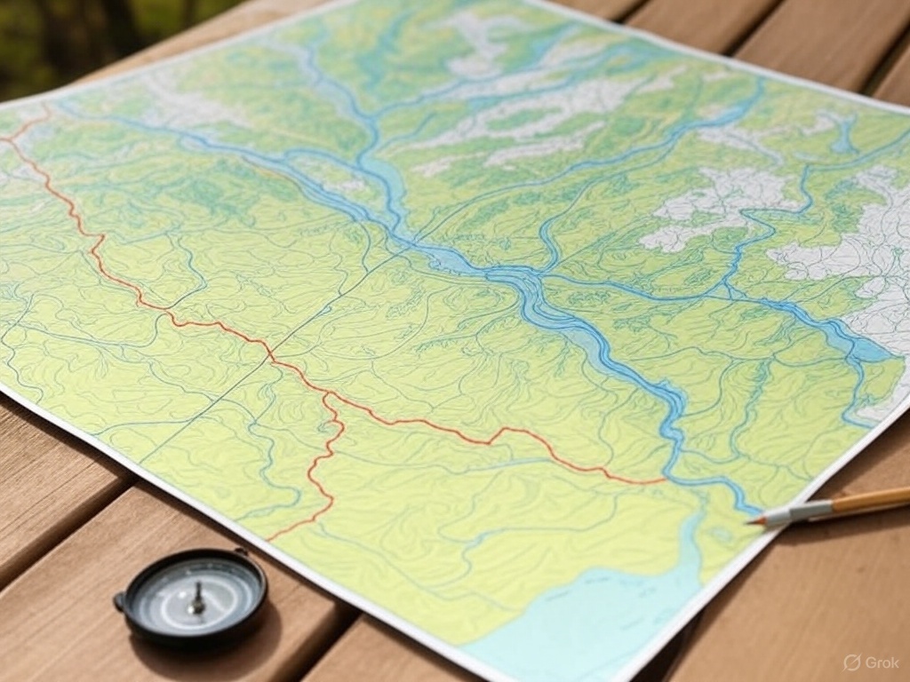
Printing
When comparing Caltopo’s printing capabilities to those of GaiaGPS and OnX, several distinctions highlight Caltopo’s advantages, particularly in terms of customization and flexibility.
Caltopo’s Printing Capabilities
- Custom Scales: Caltopo allows users to print maps at fixed, custom scales, providing the flexibility to choose the level of detail that best suits their needs. This is particularly beneficial for users who require precise navigation tools, as it ensures that the printed map includes all necessary details at a readable scale.
- Layout Customization: Users can customize the map layout extensively, including paper size, orientation, grid lines, and additional information like elevation profiles or notes. This level of customization ensures that the printed map is tailored to the specific requirements of the trip and user preferences.
- High-Quality Output: Caltopo’s printing capabilities produce high-quality maps that are clear and detailed, making them reliable resources for field use.
GaiaGPS and OnX Printing Capabilities
- Limited Customization: While GaiaGPS and OnX offer printing options, they generally provide less flexibility in terms of custom scales and layout customization. Users may find it challenging to adjust the scale to their exact preferences, which can limit the level of detail available on the printed map.
- Standardized Layouts: The printing options in GaiaGPS and OnX tend to be more standardized, with fewer options for adding custom elements like grid lines or additional notes. This can be a limitation for users who need specific information included on their maps.
- Quality and Detail: While both platforms offer decent quality prints, the lack of customization in scale and layout may result in maps that are less tailored to the user’s specific needs, potentially impacting their utility in the field.
Caltopo’s superior printing capabilities, particularly its ability to print at fixed, custom scales and its extensive layout customization options, make it a more versatile and user-friendly choice compared to GaiaGPS and OnX. These features ensure that users can create high-quality, detailed maps that are perfectly suited to their navigation needs, providing a reliable backup to digital tools and enhancing safety during outdoor adventures.
Efficiency in Planning
The combination of these map layers and overlays allows users to plan routes that are both safe and efficient. By visualizing the terrain in multiple dimensions and considering various environmental factors, users can select routes that minimize risk and optimize travel time. This level of detail and customization is not as readily accessible in GaiaGPS or OnX, making Caltopo the preferred choice for those who require a high degree of precision in their trip planning.
Caltopo’s ability to provide highly detailed and customizable maps through the layering of different map types and the addition of critical overlays is a key reason for its superiority in trip planning. This functionality empowers users to make informed decisions, ensuring that their outdoor adventures are both safe and enjoyable.
Tools
Caltopo’s robust set of tools for route planning and analysis is a major advantage for outdoor enthusiasts who need to meticulously plan their trips. These tools provide users with the ability to assess and refine their routes with a high degree of precision, ensuring that they are well-prepared for the challenges they may encounter. Let’s explore these features in more detail:
Elevation Profiles
One of the standout features of Caltopo is its ability to generate detailed elevation profiles for planned routes. This tool provides a graphical representation of the changes in elevation along a route, allowing users to visualize the ascent and descent they will face. Understanding the elevation profile is crucial for several reasons:
- Assessing Difficulty: By examining the elevation profile, users can gauge the overall difficulty of a route. Steep ascents and descents can significantly impact the physical demands of a trip, and knowing these in advance helps in preparing adequately.
- Pacing and Timing: Elevation profiles help users estimate the time required to complete a route. Steeper sections may require slower pacing, and having this information allows for more accurate time management.
- Energy Management: Knowing the elevation changes helps in planning rest stops and managing energy levels, ensuring that users are not caught off guard by unexpected climbs.
Distance Measurement
Caltopo’s distance measurement tool allows users to calculate the total distance of a planned route with precision. This feature is essential for:
- Trip Planning: Accurate distance measurements help in planning daily travel goals and ensuring that the route is feasible within the available time frame.
- Resource Allocation: Knowing the distance helps in planning for necessary resources such as food, water, and camping supplies, ensuring that users are adequately prepared for the journey.
Route Drawing and Editing
Caltopo provides intuitive tools for drawing and editing routes directly on the map. This functionality is particularly beneficial for:
- Custom Route Creation: Users can create custom routes that align with their specific goals and preferences, rather than relying solely on pre-existing trails.
- Adjustments and Refinements: The ability to edit routes allows users to make adjustments based on new information or changing conditions, such as weather or trail closures.
- Precision and Control: Caltopo’s interface is designed to offer a high level of precision and control, enabling users to fine-tune their routes to match their exact requirements.
Comparison with GaiaGPS and OnX
While GaiaGPS and OnX offer some similar functionalities, Caltopo’s interface is often considered more intuitive and user-friendly, especially for those who require detailed planning and analysis. Caltopo’s focus on providing a comprehensive set of tools for route planning and analysis makes it particularly appealing to users who need to delve deeply into the specifics of their trip.
Caltopo’s robust set of tools for route planning and analysis provides users with the ability to meticulously plan their trips, assess route difficulty, and make necessary adjustments with precision. This level of detail and control is essential for ensuring a safe and successful outdoor adventure, making Caltopo the preferred choice for those who demand a high degree of accuracy in their planning process.
Collaboration/Teams
Caltopo’s collaborative features are a significant asset for planning group trips, as they enable seamless communication and coordination among all participants. These features ensure that everyone involved in the trip has access to the same information, which is crucial for safety, efficiency, and overall trip success. Let’s explore these collaborative capabilities in more detail:
Sharing Maps and Routes
Caltopo allows users to easily share maps and routes with others, which is particularly beneficial for group trips. This sharing capability includes:
- Link Sharing: Users can generate shareable links to their maps and routes, allowing others to view and interact with the planned trip details. This feature is straightforward and does not require recipients to have a Caltopo account, making it accessible to all participants.
- Real-Time Collaboration: Caltopo supports real-time collaboration, enabling multiple users to view and edit maps simultaneously. This functionality is ideal for group planning sessions, where team members can contribute their insights and make adjustments on the fly.
- Permission Controls: Users can set permissions for shared maps, determining whether others can view only or have editing capabilities. This control ensures that the map’s integrity is maintained while allowing for collaborative input.
Streamlined Communication
The ability to share detailed maps and routes facilitates clear communication among group members. This clarity is essential for:
- Coordinated Planning: By having access to the same map, all participants can discuss and agree on the route, waypoints, and contingency plans. This coordination helps prevent misunderstandings and ensures that everyone is aligned with the trip objectives.
- Safety and Preparedness: Sharing maps with detailed overlays, such as weather conditions and potential hazards, ensures that all participants are aware of the risks and can prepare accordingly. This shared knowledge enhances group safety and decision-making.
- Logistical Coordination: For trips involving multiple vehicles or meeting points, shared maps help coordinate logistics, ensuring that everyone knows where to meet and the planned route.
Comparison with GaiaGPS and OnX
While GaiaGPS and OnX offer some sharing capabilities, Caltopo’s features are often considered more streamlined and user-friendly. The ease of generating shareable links and the ability to collaborate in real-time make Caltopo particularly appealing for group trips. Additionally, Caltopo’s permission controls provide a level of flexibility that is not as readily available in the other platforms.
Caltopo’s collaborative features are a key advantage for planning group trips. The platform’s ability to facilitate seamless sharing and real-time collaboration ensures that all participants have access to the same information, enhancing communication, coordination, and safety. These capabilities make Caltopo the superior choice for groups who need to work together effectively in planning their outdoor adventures.
Integrations
Caltopo’s integration with other tools and platforms significantly enhances its utility, making it a versatile choice for outdoor enthusiasts who require seamless transition from planning to execution. This integration ensures that the meticulous planning done on Caltopo can be effectively utilized in the field, providing users with real-time navigation and tracking capabilities. Let’s explore these integration features in more detail:
Integration with GPS Devices
Caltopo’s compatibility with GPS devices is a major advantage for users who rely on precise navigation tools during their trips. This integration includes:
- Exporting Routes and Waypoints: Users can export routes and waypoints created in Caltopo to various GPS formats, such as GPX or KML. This allows for easy transfer of planned routes to GPS devices, ensuring that users have access to their detailed plans even in areas without cellular service.
- Real-Time Tracking: Some GPS devices can sync with Caltopo, allowing for real-time tracking of the user’s location on the map. This feature is invaluable for monitoring progress, adjusting routes as needed, and ensuring that the user stays on track.
- Data Import: Users can import data from GPS devices back into Caltopo, such as recorded tracks or waypoints. This capability allows for post-trip analysis and refinement of future plans based on actual field data.
Mobile App Integration
Caltopo’s integration with mobile apps further enhances its utility by providing users with on-the-go access to their maps and plans. Key aspects of this integration include:
- Offline Access: Caltopo’s mobile app allows users to download maps for offline use, ensuring that they have access to critical information even in remote areas without internet connectivity. This feature is essential for maintaining navigation capabilities in the backcountry.
- Synchronization: The mobile app syncs with the web platform, ensuring that any changes made to maps or routes are updated across devices. This synchronization provides consistency and reliability, allowing users to switch between devices without losing information.
- Interactive Features: The mobile app retains many of the interactive features available on the web platform, such as measuring distances, viewing elevation profiles, and adding waypoints. This functionality allows users to make informed decisions in the field, adapting to changing conditions as needed.
Enhanced Safety and Peace of Mind
The integration of Caltopo with GPS devices and mobile apps enhances safety and provides peace of mind for several reasons:
- Reliable Navigation: By having access to detailed maps and real-time tracking, users can navigate with confidence, reducing the risk of getting lost or deviating from the planned route.
- Adaptability: The ability to update routes and access real-time data allows users to adapt to unforeseen circumstances, such as weather changes or trail closures, ensuring that they can make informed decisions to maintain safety.
- Communication: Some GPS devices and mobile apps offer communication features, such as sending location updates to emergency contacts. This capability adds an extra layer of safety, allowing users to stay connected with others even in remote areas.
Caltopo’s integration with GPS devices and mobile apps significantly enhances its utility by providing users with reliable navigation and tracking capabilities. This integration ensures that the detailed planning done on Caltopo can be effectively utilized in the field, enhancing safety and providing peace of mind for outdoor adventurers.
Pricing
Caltopo’s pricing model is a significant factor in its appeal, offering flexibility and accessibility that cater to a wide range of users, from casual adventurers to serious outdoor enthusiasts. This model stands out when compared to the subscription-based services of GaiaGPS and OnX, providing users with options that align with their specific needs and budgets. Let’s explore the details of Caltopo’s pricing structure and its advantages:
Free Version with Substantial Features
Caltopo offers a free version that includes a robust set of features, making it an attractive option for users who need basic mapping and planning tools without incurring any cost. Key features available in the free version include:
- Basic Map Layers: Users have access to essential map layers such as topographic, satellite, and terrain maps, allowing for comprehensive route planning and terrain analysis.
- Route Planning Tools: The free version includes tools for drawing and editing routes, measuring distances, and generating elevation profiles, providing users with the necessary capabilities for effective trip planning.
- Limited Sharing and Collaboration: While the free version offers basic sharing capabilities, it allows users to collaborate with others, albeit with some restrictions compared to the paid plans.
Affordable Paid Plans
For users who require more advanced features, Caltopo offers affordable paid plans that unlock additional capabilities. These plans are designed to cater to different levels of usage and requirements:
- Pro Plan: This plan includes advanced features such as offline map downloads, enhanced sharing and collaboration tools, and access to premium map layers. It is ideal for users who need more comprehensive planning tools and the ability to work offline.
- Team Plan: Designed for groups and organizations, the Team Plan offers collaborative features that facilitate group planning and coordination. It includes options for multiple users to access and edit maps, making it suitable for clubs, schools, or professional teams.
- Enterprise Solutions: For large organizations or specialized needs, Caltopo provides enterprise solutions with custom features and support, ensuring that even the most demanding users have access to the tools they need.
Flexibility and Accessibility
Caltopo’s pricing model is characterized by its flexibility, allowing users to choose a plan that best suits their needs and budget. This flexibility offers several advantages:
- Cost-Effectiveness: Users can start with the free version and upgrade to a paid plan as their needs evolve, ensuring that they only pay for the features they require.
- Scalability: The availability of different plans makes Caltopo scalable, accommodating users as their level of expertise and planning requirements grow.
- Inclusivity: By offering a free version with substantial features, Caltopo ensures that even those with limited budgets can access high-quality mapping and planning tools, promoting inclusivity in outdoor activities.
Caltopo’s pricing model is a key factor in its appeal, providing a range of options that cater to diverse user needs and budgets. The combination of a feature-rich free version and affordable paid plans makes Caltopo an accessible and flexible choice for both casual adventurers and serious outdoor enthusiasts, setting it apart from the more rigid subscription models of GaiaGPS and OnX.
Conclusion
My preference for Caltopo over GaiaGPS and OnX is rooted in several key attributes that collectively make it an indispensable tool for trip planning. These attributes ensure that every adventure is well-prepared and executed with confidence, providing both functionality and reliability. Let’s explore these attributes in more detail:
Superior Map Customization
Caltopo’s map customization capabilities are unparalleled, allowing users to tailor maps to their specific needs. This includes layering different types of maps, such as topographic, satellite, and terrain maps, to create a comprehensive view of the area. Users can add overlays like slope angle shading, land management boundaries, and weather data, providing critical information for route planning and risk assessment. This level of customization is essential for understanding complex terrains and making informed decisions.
Comprehensive Planning Tools
Caltopo offers a robust set of planning tools that are essential for assessing and refining routes. Features like elevation profiles, distance measurement, and precise route drawing and editing allow users to evaluate the difficulty of a route and make necessary adjustments. These tools are intuitive and provide a high level of detail and control, ensuring that users can plan their trips with precision and confidence.
Collaborative Features
For group trips, Caltopo’s collaborative features are invaluable. The platform allows users to share maps and routes easily, facilitating seamless communication and coordination among participants. Real-time collaboration and permission controls ensure that everyone is on the same page, enhancing safety and efficiency. This capability is more streamlined and user-friendly compared to GaiaGPS and OnX, making Caltopo the superior choice for group planning.
Integration Capabilities
Caltopo’s integration with GPS devices and mobile apps enhances its utility by providing real-time navigation and tracking during trips. Users can export routes to GPS devices, access maps offline via the mobile app, and sync data across platforms. This integration ensures that the detailed planning done on Caltopo can be effectively utilized in the field, providing peace of mind and enhancing safety.
Flexible Pricing
Caltopo’s pricing model offers flexibility and accessibility, with a free version that includes substantial features and affordable paid plans that unlock additional capabilities. This range of options allows users to choose a plan that best suits their needs and budget, making Caltopo accessible to both casual adventurers and serious outdoor enthusiasts. The cost-effectiveness and scalability of Caltopo’s pricing model set it apart from the subscription-based services of GaiaGPS and OnX.
Caltopo’s superior map customization, comprehensive planning tools, collaborative features, integration capabilities, and flexible pricing make it an indispensable tool for trip planning. Whether navigating complex terrains or coordinating with a group, Caltopo provides the functionality and reliability needed to make outdoor adventures both enjoyable and safe. These attributes ensure that users can approach their adventures with confidence, knowing that they are well-prepared for whatever challenges they may encounter.


Leave a Reply