
Overlanding has surged in popularity, thanks in part to the accessibility of powerful digital planning tools. While technology has revolutionized route planning, navigation, and trip management, the unpredictable nature of remote travel means that traditional offline and paper maps remain essential. This essay explores how to effectively combine modern computer tools with physical backups to plan a safe and successful overlanding expedition.
Digital Tools for Overlanding Planning
CalTopo: Custom Mapping and Route Design
CalTopo has become an indispensable resource for overlanders who demand precision and flexibility in their trip planning. Unlike many mapping platforms that offer only basic navigation, CalTopo empowers users to create highly customized maps tailored to the unique demands of overland travel. At its core, CalTopo allows users to overlay a variety of map types—such as USGS topographic maps, satellite imagery, shaded relief, and public land boundaries—onto a single, interactive workspace. This layering capability is particularly valuable for overlanders, as it enables a comprehensive understanding of both the terrain and the legal status of the land they intend to traverse.
One of CalTopo’s most powerful features is its route plotting tool. Users can draw precise routes and mark waypoints directly on the map, specifying locations for campsites, water sources, fuel stops, or potential hazards. Each route segment can be analyzed for distance, elevation gain, and slope, providing critical information for assessing the difficulty and feasibility of each leg. This is especially useful when planning to travel through remote or rugged areas, where understanding elevation profiles and terrain features can mean the difference between a safe journey and an impassable obstacle.
CalTopo also excels in its ability to generate high-resolution, printable maps. Before heading into areas with unreliable connectivity, overlanders can print custom maps that include all their planned routes, waypoints, and notes. These printed maps serve as a vital backup and can be tailored to the exact scale and area needed, ensuring that no critical detail is left out.
Collaboration is another area where CalTopo shines. The platform allows users to share their maps with others, making it easy for groups to coordinate routes, divide responsibilities, and ensure everyone is on the same page. Real-time collaboration features mean that changes made by one team member can be instantly visible to others, streamlining the planning process and reducing the risk of miscommunication.
CalTopo’s combination of customizable mapping, detailed route analysis, offline map generation, and collaborative planning tools makes it a cornerstone of modern overlanding preparation. It bridges the gap between digital convenience and the practical realities of remote travel, equipping adventurers with the information and resources they need to plan confidently and adapt to changing conditions on the ground.
AllTrails: Trail Discovery and Community Insights
AllTrails has established itself as a go-to platform for outdoor enthusiasts seeking to explore new trails, and its value extends well into the realm of overlanding. What sets AllTrails apart is its extensive, ever-growing database of trails, which covers not only hiking paths but also off-road vehicle routes, mountain biking tracks, and even some lesser-known backcountry roads. This breadth of coverage means that overlanders can use AllTrails to discover both primary routes and hidden gems that might otherwise go unnoticed.
A key feature of AllTrails is the wealth of user-generated content that accompanies each trail entry. Every trail profile typically includes detailed descriptions, up-to-date difficulty ratings, and a rich gallery of photos contributed by the community. These firsthand accounts provide invaluable context, helping overlanders gauge whether a particular trail or detour matches their vehicle’s capabilities and their group’s experience level. The photos and reviews often highlight current trail conditions, seasonal obstacles, and points of interest, offering a real-world perspective that static maps alone cannot provide.
AllTrails also excels in its integration of GPS tracking and offline map functionality. Before setting out, users can download maps directly to their mobile devices, ensuring that navigation remains possible even in areas without cellular service. The app’s GPS tracking feature allows overlanders to monitor their progress in real time, follow pre-planned routes, and mark waypoints for campsites, water sources, or scenic overlooks. This digital navigation capability is especially useful for identifying and exploring side hikes or scenic detours that branch off from the main overlanding route.
Perhaps most importantly, AllTrails fosters a sense of community among its users. The platform encourages feedback on trail conditions, hazards, and recent changes, creating a dynamic repository of up-to-date information. Overlanders can benefit from this collective knowledge, learning from the experiences of others who have recently traveled the same paths. This community-driven approach not only enhances safety but also inspires confidence and curiosity, encouraging travelers to venture beyond the obvious and discover new adventures along the way.
AllTrails serves as both a discovery engine and a real-time information hub for overlanders. Its combination of comprehensive trail data, user insights, and robust offline navigation tools makes it an essential companion for anyone planning to explore the backcountry, whether by vehicle or on foot.
TrailsOffroad: Specialized Off-Road Information
TrailsOffroad distinguishes itself by focusing exclusively on the needs of off-road and overlanding enthusiasts, offering a depth of information that general mapping platforms often lack. At the heart of TrailsOffroad’s value is its collection of meticulously researched trail guides. Each guide is crafted with the overlander in mind, providing not just a route but a comprehensive overview of what to expect along the way. These guides include technical ratings that describe the difficulty of the trail, taking into account factors such as terrain type, steepness, and the presence of obstacles. This level of detail is crucial for overlanders, as it allows them to realistically assess whether a particular trail is suitable for their vehicle—be it a stock SUV or a heavily modified 4×4—and for the skill level of their group.
Beyond the general trail overview, TrailsOffroad enhances trip planning by pinpointing specific waypoints along each route. These waypoints are more than just navigational aids; they mark significant features such as challenging rock gardens, water crossings, scenic viewpoints, and established campsites. By providing precise GPS coordinates for these locations, the platform enables overlanders to anticipate and prepare for obstacles, plan rest stops, and identify potential overnight locations well in advance. This granular information is especially valuable in remote areas where on-the-ground scouting is impractical or impossible before arrival.
Another key advantage of TrailsOffroad is its robust offline functionality. Recognizing that many of the best overlanding destinations are far from reliable cell service, the platform allows users to download trail data, maps, and waypoints directly to their devices. This ensures that critical information remains accessible even in the most isolated environments, reducing the risk of getting lost or encountering unexpected hazards without warning.
Perhaps most importantly, TrailsOffroad empowers overlanders to make informed decisions about their routes. By combining technical trail ratings, detailed waypoints, and offline access, it helps travelers match their chosen paths to their vehicles’ capabilities and their own experience levels. This not only enhances safety but also increases the likelihood of a successful and enjoyable expedition, free from avoidable setbacks or dangerous surprises. In essence, TrailsOffroad acts as both a guide and a safeguard, equipping overlanders with the specialized knowledge they need to confidently explore off-the-beaten-path destinations.
TrailsOffroad sets itself apart by offering in-depth, specialized information tailored to off-road and overlanding travelers. Its detailed trail guides provide not only routes but also technical ratings and comprehensive overviews, helping users assess whether a trail matches their vehicle and skill level. The platform further aids planning by marking key waypoints—such as obstacles, campsites, and scenic spots—with precise GPS coordinates, allowing for better preparation and safer travel. With robust offline capabilities, TrailsOffroad ensures that critical information is always accessible, even in remote areas without cell service. Ultimately, it empowers overlanders to make informed, safe decisions and confidently explore challenging, less-traveled routes.
iOverlander: Community-Sourced Resources for Overlanders
iOverlander is a unique tool in the overlanding world, serving as a global, community-driven database of practical resources and points of interest for travelers. Unlike traditional mapping or trail-planning platforms, iOverlander focuses on the essential services and amenities that overlanders need while on the road, such as campsites, water fill stations, fuel stops, mechanics, border crossings, and even places to find food or Wi-Fi. Each entry is contributed and updated by fellow travelers, ensuring that the information remains current and relevant.
The strength of iOverlander lies in its grassroots approach. Users can read detailed descriptions, see photos, and review comments about each location, gaining insight into the quality, accessibility, and safety of a site before arrival. This is especially valuable in remote or unfamiliar regions, where official information may be scarce or outdated. The platform’s search and filter functions make it easy to find exactly what you need, whether it’s a secluded wild camping spot or a secure parking area in a busy city.
iOverlander is designed with offline use in mind. Travelers can download the entire database for a specific region or country, ensuring that they have access to critical information even when far from cellular networks. This offline capability is a lifeline for overlanders navigating remote areas, allowing them to locate resources and make informed decisions without relying on an internet connection.
By leveraging the collective knowledge and experiences of the global overlanding community, iOverlander fills a crucial gap in trip planning. It complements route-focused tools like CalTopo, AllTrails, and TrailsOffroad by providing the practical, on-the-ground information that can make the difference between a smooth journey and a logistical challenge. For overlanders, iOverlander is not just a map—it’s a living, evolving guidebook built by and for those who travel the world by road.
Additional Tools: Gaia GPS, OnX, Google Earth, and More
Other digital resources, such as Gaia GPS, OnX, and Google Earth, offer further layers of planning detail. Gaia GPS excels at layering maps and tracking progress, while Google Earth’s 3D visualization helps anticipate terrain challenges and scout campsites from above.
Comparing Overlanding Tools: Free vs. Subscription and Value Ranking
When selecting digital tools for overlanding, cost and value are important considerations. Each platform—CalTopo, AllTrails, TrailsOffroad, and iOverlander—offers a different balance of free features and paid subscriptions, as well as varying degrees of utility depending on the needs of the traveler. Below is a comparative overview and ranking based on accessibility, feature set, and overall value for overlanders.
CalTopo
CalTopo offers a robust free version that allows users to create and print custom maps, plot routes, and access a variety of map layers. However, advanced features such as high-resolution map printing, offline mobile access, and additional map layers require a paid subscription. The subscription tiers are reasonably priced, and the value increases significantly for those who need detailed planning and offline capabilities.
AllTrails
AllTrails provides a free version with access to its extensive trail database, user reviews, and basic GPS tracking. However, the most useful features for overlanders—such as offline map downloads, advanced map layers, and real-time tracking—are locked behind the AllTrails+ (formerly AllTrails Pro) subscription. The subscription is moderately priced and is particularly valuable for those who frequently venture into areas without cell service.
TrailsOffroad
TrailsOffroad offers limited free access, typically allowing users to view a small selection of trail guides and basic information. To unlock the full database, detailed trail guides, offline access, and advanced features, a paid subscription is required. The subscription cost is higher than some other platforms, but the depth and specificity of information—especially for technical off-road routes—make it worthwhile for serious overlanders.
iOverlander
iOverlander has long been valued as a free, community-driven resource for overlanders, offering a global database of campsites, services, and points of interest contributed by travelers. The free tier continues to provide access to the core database, allowing users to search for and contribute information about campsites, water sources, fuel stops, mechanics, and more. Offline access to downloaded regions remains available, making it a reliable tool for remote travel.
With the introduction of iOverlander Pro, the platform now offers a subscription tier that enhances the user experience with additional features. iOverlander Pro includes benefits such as advanced search and filtering options, the ability to download larger regions or entire countries for offline use, and early access to new features as they are developed. Pro users may also enjoy an ad-free experience and priority support, making the app more streamlined and efficient for frequent or long-term travelers.
The free version of iOverlander remains highly functional and accessible, providing the essential features needed for most overlanders, especially those on a budget or just starting out. However, for those who travel extensively, require more robust offline capabilities, or want to support the ongoing development of the platform, iOverlander Pro offers meaningful upgrades that can enhance trip planning and on-the-road convenience.
Value Ranking Table
| Tool | Free Features | Subscription Needed for Full Value | Offline Access | Value Ranking |
|---|---|---|---|---|
| iOverlander | Core database, basic offline maps | Yes (Pro: advanced search, larger offline regions, ad-free, priority support) | Yes | 4.5 |
| CalTopo | Good, but limited | Yes (for advanced/offline) | Yes | 4 |
| AllTrails | Basic features | Yes (for offline/advanced) | Yes | 3.5 |
| TrailsOffroad | Very limited | Yes (for most features) | Yes | 3 |
With the addition of a paid tier, iOverlander remains a top-value tool for overlanders, especially given its robust free offering. The Pro subscription is best suited for those who need enhanced offline capabilities and advanced features, while the free tier continues to serve the majority of users effectively.
My Choices
In my own overlanding trip planning workflow, I rely on a combination of SARTopo (the search-and-rescue-focused version of CalTopo), TrailsOffroad, and Google Earth, each serving a distinct and complementary purpose. SARTopo is my foundational tool for route design and logistics; its robust layering options, detailed topographic data, and the ability to plot custom routes and waypoints make it indispensable for mapping out the overall journey and identifying potential challenges. Once I have a preliminary route, I turn to TrailsOffroad to cross-reference my plans with their expertly curated trail guides. This step is crucial for verifying trail difficulty, vehicle suitability, and for pinpointing obstacles, campsites, and other key waypoints that might not be obvious from maps alone. As a final step, I use Google Earth to visualize the entire trip in three dimensions. This allows me to “fly over” the planned route, gaining a real sense of the terrain, elevation changes, and surrounding landscape. The combination of these tools gives me both the granular detail needed for safe, informed planning and the big-picture perspective that helps ensure a smooth and enjoyable expedition.
The Importance of Offline and Paper Maps
Technology’s Limitations in Remote Areas
While digital mapping tools have revolutionized the way overlanders plan and navigate their journeys, the realities of remote travel expose the inherent vulnerabilities of relying solely on technology. In the backcountry, far from the conveniences of urban infrastructure, the limitations of electronic devices become starkly apparent. One of the most common issues is battery depletion. Even with careful power management, extended trips and cold weather can drain batteries faster than expected, and opportunities to recharge may be few and far between. Solar chargers and power banks can help, but they are not foolproof solutions, especially during periods of bad weather or heavy use.
Device malfunctions present another significant risk. Tablets, smartphones, and GPS units are susceptible to damage from moisture, dust, vibration, and accidental drops—hazards that are all too common on rough trails and in unpredictable weather. A cracked screen or a waterlogged device can instantly cut off access to critical navigation data. Furthermore, software glitches, corrupted files, or failed updates can render apps unusable at the worst possible moment.
Perhaps the most fundamental limitation is the lack of cellular coverage in remote areas. Many mapping apps rely on an internet connection to load maps, update routes, or access real-time information. In the wilderness, however, cell signals are often nonexistent. This makes it essential to download all necessary maps and data for offline use before departure. Even then, the quality and detail of offline maps can vary between platforms, and some features—such as live weather updates or user-submitted trail reports—may be inaccessible without connectivity.
Given these vulnerabilities, relying exclusively on digital tools is a gamble that can compromise both safety and the overall experience. At a minimum, overlanders should ensure that all relevant maps, routes, and waypoints are downloaded to their devices and tested for offline functionality before setting out. Redundancy is key: having backup devices, extra batteries, and multiple apps can provide additional layers of security. However, even the best-prepared digital setup cannot fully eliminate the risks posed by technology’s limitations in remote environments, underscoring the enduring importance of physical navigation aids.
The Role of Paper Maps
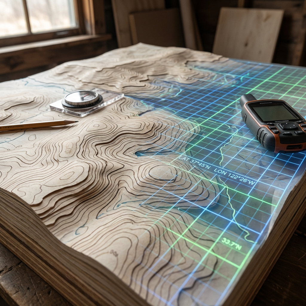
Paper maps remain an essential tool for overlanders, offering a level of reliability and perspective that digital devices cannot always match. One of the most significant advantages of paper maps is their immunity to technical failures. Unlike electronic devices, paper maps do not rely on batteries, software, or connectivity; they are always accessible, regardless of weather conditions, power availability, or the presence of a cell signal. This makes them a critical backup in situations where technology falters—whether due to dead batteries, broken screens, or unexpected malfunctions.
Beyond their reliability, paper maps provide a broad, holistic view of the landscape that is often difficult to achieve on a small digital screen. With a single glance, you can see the entire region, trace your route, and understand the relationship between various landmarks, roads, and natural features. This big-picture perspective is invaluable for strategic planning, especially when rerouting becomes necessary due to unexpected obstacles or changing conditions. It allows you to quickly identify alternate routes, detours, or escape options without the need to zoom and scroll through multiple digital map tiles.
Paper maps are also highly customizable. Overlanders can annotate them with personal notes, mark campsites, water sources, and hazards, or highlight alternate routes and emergency contacts. These annotations become a living record of your journey and can be shared with others or referenced on future trips. In group travel scenarios, a paper map can be spread out and discussed collectively, facilitating clear communication and collaborative decision-making.
For each leg of an overlanding expedition, carrying the relevant topographic maps—ideally at both regional and detailed scales—ensures that you are prepared for any navigational challenge. Pairing these maps with a reliable compass provides a fail-safe method of orientation, allowing you to navigate confidently even if all electronic aids are lost. In remote areas where landmarks may be sparse and trails unmarked, the ability to read contour lines, judge distances, and orient yourself using a map and compass is a fundamental skill that can make the difference between a minor inconvenience and a serious emergency.
One of the most practical ways to bridge the gap between digital planning and analog reliability is by printing route-specific paper maps directly from SARTopo. This platform excels not only in digital route creation but also in its ability to generate highly customized, high-resolution maps tailored to your exact journey. Before departure, you can use SARTopo to overlay your planned route, waypoints, and critical features—such as water sources, campsites, and potential hazards—onto a variety of base maps, including topographic, satellite, and public land layers. The print function allows you to select the precise area and scale you need, ensuring that every segment of your trip is covered in detail. These printed maps can be annotated with additional notes or emergency contacts and carried in a waterproof case for easy access on the trail. By preparing route-specific paper maps from SARTopo, you gain the confidence of having up-to-date, relevant navigation aids that reflect your actual plans, seamlessly integrating the strengths of digital mapping with the dependability of paper navigation.
Paper maps are a crucial backup for overlanders, offering unmatched reliability since they don’t depend on batteries, software, or connectivity and are immune to technical failures. They provide a comprehensive, big-picture view of the landscape, making it easier to plan routes, identify alternatives, and understand the terrain at a glance—something that’s often difficult on small digital screens. Paper maps can be customized with notes, campsites, hazards, and emergency contacts, serving as both a living record and a collaborative tool for group planning. Carrying detailed topographic maps and a compass for each leg of the journey ensures navigation remains possible even if all electronics fail. Printing route-specific maps from SARTopo further enhances preparedness, allowing you to create customized, up-to-date paper maps that reflect your actual plans and integrate the best of digital and analog navigation.
Integrating Digital and Physical Planning
The integration of digital and physical planning is at the heart of a resilient and effective overlanding strategy. Digital tools such as SARTopo, TrailsOffroad, and Google Earth offer unparalleled convenience and precision during the pre-trip phase. With these platforms, you can meticulously design your route, analyze elevation profiles, overlay land use boundaries, and pinpoint hazards or points of interest. The ability to zoom in for granular detail or zoom out for a regional overview allows for comprehensive trip planning, while features like real-time collaboration and user-generated trail reports help refine your itinerary based on the latest information.
However, the planning process does not end with digital mapping. The next critical step is to translate your digital plans into physical resources. By printing custom maps—especially those tailored to your specific route and annotated with campsites, water sources, and alternate paths—you create a tangible backup that is immune to the vulnerabilities of technology. These paper maps can be organized by trip segment and stored in a waterproof folder, ready for quick reference at any time.
Once on the road, the interplay between digital and physical resources becomes even more important. Digital devices excel at real-time navigation, GPS tracking, and dynamic rerouting, making them invaluable for following your planned path and adapting to changing conditions. Yet, when you need to step back and reassess your overall progress, or when technology fails due to battery loss, damage, or lack of connectivity, paper maps provide a reliable and immediate overview. They allow you to maintain situational awareness, communicate plans with your group, and make informed decisions without the distraction or limitations of a small screen.
This dual approach—using digital tools for detailed planning and navigation, and paper maps for backup and big-picture perspective—maximizes both safety and flexibility. It ensures that you are prepared for the unexpected, whether that means a sudden detour, a technical failure, or simply the need to regroup and reorient. By thoughtfully integrating both digital and physical resources, overlanders can confidently tackle remote and challenging environments, knowing they have the tools to adapt and succeed no matter what the journey brings.
Conclusion
The landscape of overlanding trip planning has been fundamentally reshaped by the advent of modern computer tools such as CalTopo, AllTrails, and TrailsOffroad. These platforms empower travelers to plan with a level of detail and foresight that was once unimaginable. With just a few clicks, overlanders can design intricate routes, analyze terrain, assess trail difficulty, and access up-to-date community insights. The ability to overlay multiple map types, download offline data, and visualize journeys in three dimensions has made it possible to anticipate challenges, optimize logistics, and maximize the enjoyment of every expedition.
Yet, as transformative as these digital tools are, the very nature of overlanding—traveling through remote, unpredictable, and often harsh environments—means that technology alone cannot guarantee safety or success. Devices can fail, batteries can die, and connectivity can vanish without warning. In these moments, the value of offline and paper maps becomes clear. Physical maps provide a fail-safe, offering a broad overview and a tangible reference that is immune to the vulnerabilities of electronics. They allow travelers to maintain situational awareness, adapt to unforeseen circumstances, and communicate plans within a group, even when digital devices are unavailable.
The most prepared and resilient overlanders are those who recognize the strengths and limitations of both digital and analog navigation. By integrating the precision, convenience, and real-time capabilities of computer tools with the reliability and perspective of paper maps, adventurers create a robust system that is greater than the sum of its parts. This blended approach not only enhances safety but also fosters a deeper connection to the journey itself, encouraging self-reliance, adaptability, and thoughtful exploration.
The combination of modern technology and traditional navigation equips overlanders to venture confidently into the world’s wildest places. Whether traversing mountain passes, navigating dense forests, or crossing arid deserts, those who plan with both digital and physical resources are best prepared to meet the challenges of the unknown—and to fully embrace the spirit of adventure that defines overlanding.


Leave a Reply