The following essay is a sanitized After Action Report (AAR) of an Elk hunt conducted by a group of tech geeks in the Western Colorado wilderness organized and coordinated by the author. I wanted to not only increase the likelihood of success for each hunter, but at the same time, test new ways to ensure better situation awareness, as well increase safety for all parties involved.
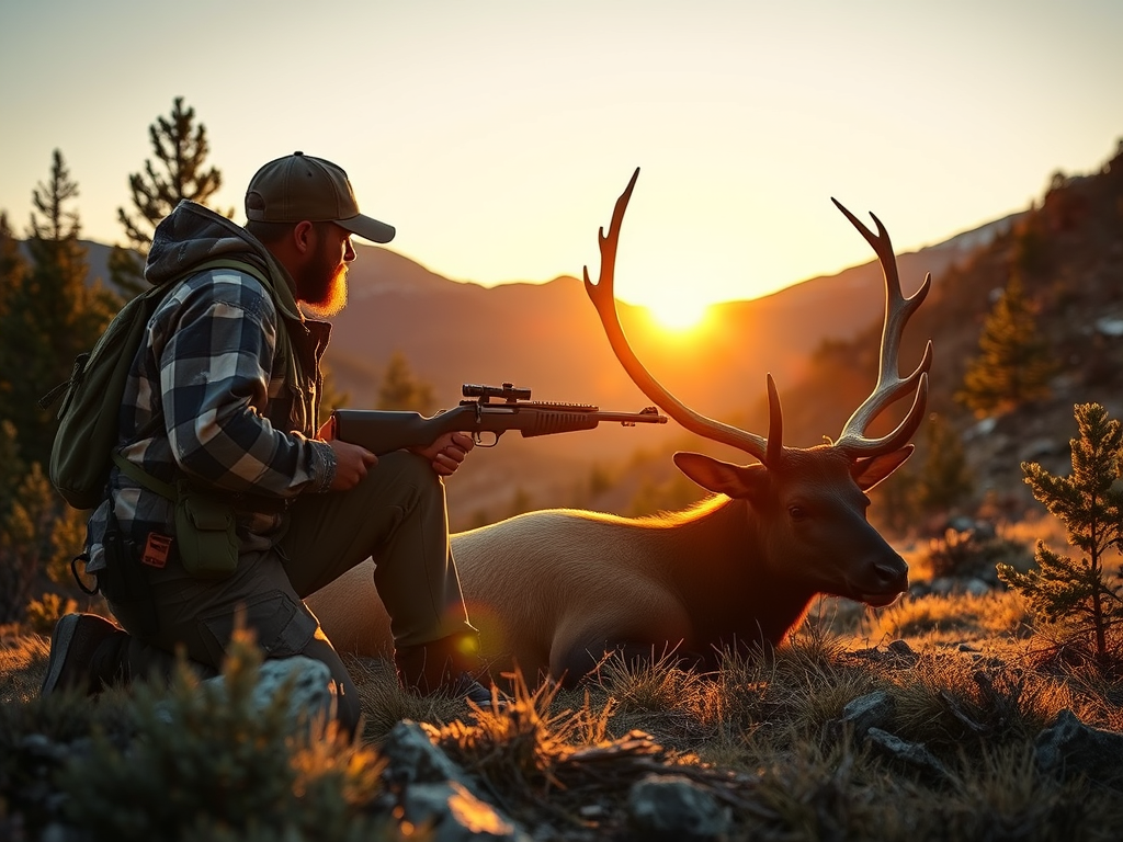
Effective communication and real-time location sharing are critical for groups operating in remote wilderness areas, especially for hunting parties. This case study explores how a group of hunters utilized the Android Team Awareness Kit (ATAK) in conjunction with Meshtastic, a low-power mesh networking solution, to enhance safety, coordination, and situational awareness during a multi-day hunting expedition.
Background
The Challenge
Limitations of Traditional Communication in the Wilderness
Hunting expeditions often take place in remote, rugged environments—mountainous forests, deep valleys, or expansive plains—where modern infrastructure is sparse or nonexistent. In such settings, hunters face several critical communication challenges:
1. Cellular Coverage Gaps
- No Signal Zones: Most wilderness areas are far from cell towers, resulting in little to no cellular signal. Even if a signal is present, it is often weak and unreliable, especially in valleys or dense forests.
- Dependence on Infrastructure: Cellular communication relies on external infrastructure, which cannot be guaranteed in remote locations. In emergencies, this lack of connectivity can be life-threatening.
2. Radio Limitations
- Limited Range: Traditional handheld radios (e.g., FRS, GMRS, or even VHF/UHF) are limited by line-of-sight and terrain. Hills, trees, and rocks can block or degrade signals, reducing effective range to just a few kilometers or less.
- Channel Congestion and Privacy: Public radio channels can become congested, and conversations are not private. Sensitive information about hunting locations or strategies may be overheard by others.
- No Location Sharing: Standard radios do not provide automatic location updates. Hunters must verbally communicate their positions, which can lead to confusion or errors.
Essential Communication Needs for Hunters
Given these limitations, hunting groups have several critical needs:
1. Real-Time Location Awareness
- Safety: Knowing where each participant is at all times helps prevent accidents, such as friendly fire or getting lost.
- Coordination: Real-time tracking allows the group to spread out efficiently, cover more ground, and avoid overlapping hunting zones.
2. Instant Updates and Information Sharing
- Animal Sightings: Quick sharing of sightings or tracks allows the group to coordinate movements and increase the chances of a successful hunt.
- Hazard Alerts: Immediate notification of hazards (e.g., injured hunter, dangerous terrain, wildlife encounters) is vital for group safety.
- Plan Adjustments: Weather changes, unexpected obstacles, or new opportunities may require rapid changes to the hunt plan.
3. Infrastructure-Free Communication
- Self-Sufficiency: Hunters need a system that works independently of external infrastructure, ensuring reliability regardless of location.
- Low Power Consumption: Devices must operate for extended periods (often days) without frequent recharging, as power sources are limited in the field.
The Need for a Modern Solution
The combination of these challenges and requirements highlights the need for a modern, robust communication system that:
- Provides real-time, map-based location sharing.
- Enables secure, reliable text communication.
- Functions entirely off-grid, without dependence on cell towers or internet.
- Is portable, durable, and energy-efficient for multi-day expeditions.
This context sets the stage for the adoption of ATAK and Meshtastic as an integrated solution for wilderness hunting groups.
The Solution
To overcome the communication and coordination challenges of wilderness hunting, the group adopted a hybrid technological approach, leveraging the strengths of both ATAK and Meshtastic. This combination provided a robust, infrastructure-free system for real-time situational awareness and messaging.
ATAK (Android Team Awareness Kit / Android Tactical Assault Kit)
Overview: ATAK is a sophisticated geospatial situational awareness tool originally developed for military and emergency response teams. It runs on Android devices and offers a rich set of features tailored for team operations in challenging environments.
Key Features for Hunters:
- Map-Based Visualization: ATAK displays high-resolution offline maps, satellite imagery, and topographic data. Hunters can see their own location and the positions of teammates in real time, even without internet access.
- Track and Waypoint Management: Users can drop waypoints for animal sightings, hazards, or rendezvous points. Tracks (movement history) can be recorded and shared, helping the group retrace steps or analyze movement patterns.
- Messaging and Alerts: ATAK supports text messaging, group chat, and alert notifications. Messages can be geotagged and linked to specific map locations.
- Plugins and Extensibility: The app supports plugins, allowing integration with external devices and systems—such as Meshtastic—for seamless data exchange.
Advantages for Hunting Groups:
- Enhanced Safety: Real-time location sharing reduces the risk of accidental encounters and helps in emergencies.
- Efficient Coordination: Visualizing all participants and points of interest on a shared map streamlines group strategy and movement.
Meshtastic
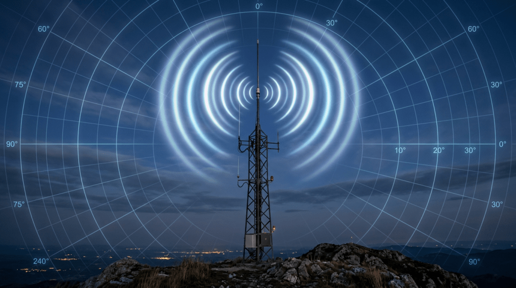
Overview: Meshtastic is an open-source project that uses affordable, low-power LoRa (Long Range) radios to create a mesh network for text and location sharing. It is designed for off-grid communication where traditional networks are unavailable.
Key Features for Hunters:
- Mesh Networking: Each Meshtastic device acts as a node, relaying messages and location data across the network. This extends communication range beyond direct line-of-sight, as messages can hop from device to device.
- Long Range, Low Power: LoRa radios can transmit several kilometers, even in dense forests or hilly terrain. Devices are optimized for low energy consumption, lasting days on a single charge.
- Text and Location Sharing: Users can send short text messages and share GPS coordinates. The system works entirely without cellular or Wi-Fi infrastructure.
- Device Pairing: Meshtastic modules connect to smartphones via Bluetooth, allowing users to interact with the network through a familiar mobile interface.
Advantages for Hunting Groups:
- Reliable Off-Grid Communication: Hunters remain connected regardless of terrain or distance from civilization.
- Privacy and Security: Encrypted communication ensures that sensitive information (e.g., hunting locations) remains confidential within the group.
- Scalability: The mesh network grows stronger as more devices join, increasing coverage and reliability.
Integration: ATAK + Meshtastic
The real power of this solution comes from integrating ATAK and Meshtastic:
- Seamless Data Flow: Meshtastic devices feed real-time location and message data into ATAK, which displays it on detailed maps.
- Unified Interface: Hunters use ATAK as a single dashboard for navigation, communication, and situational awareness, while Meshtastic handles the underlying mesh networking.
- Offline Capability: Both systems are designed to work without internet or cell service, making them ideal for remote wilderness operations.
By combining ATAK’s advanced mapping and team coordination features with Meshtastic’s robust, long-range mesh communication, the hunting group achieved:
- Real-time, map-based tracking of all participants.
- Reliable, infrastructure-free messaging and updates.
- Enhanced safety, efficiency, and success in the field.
This solution represents a significant technological leap for wilderness hunting, setting a new standard for group communication and situational awareness in remote environments.
Implementation
Equipment Setup
A successful deployment of ATAK and Meshtastic for a hunting group in the wilderness requires careful planning and configuration of both hardware and software. Below is a detailed exploration of the equipment setup process:
1. Meshtastic LoRa Radio Modules
Device Selection: Each hunter was issued a portable LoRa radio module compatible with Meshtastic firmware. Popular choices included:
- Heltec WiFi LoRa 32
- TTGO T-Beam
- LilyGO T-Echo
These devices are compact, lightweight, and feature built-in GPS modules, rechargeable batteries, and external antenna connectors for improved range.
Power Considerations:
- Devices were charged before the trip and supplemented with portable USB power banks for multi-day use.
- Battery life was optimized by adjusting transmission intervals and using sleep modes when stationary.
Physical Setup:
- Radios were carried in waterproof pouches or mounted on backpacks for optimal antenna exposure.
- Each device was labeled with the hunter’s name or call sign for easy identification.
2. Bluetooth Pairing with Android Phones
Pairing Process:
- Each LoRa module was paired via Bluetooth to the hunter’s Android smartphone.
- The official Meshtastic app was installed on each phone, providing a user-friendly interface for device configuration and messaging.
Configuration Steps:
- Bluetooth pairing was initiated from the phone’s settings, then confirmed within the Meshtastic app.
- Device names and user profiles were set up to match each hunter’s identity.
Benefits:
- The phone’s touchscreen and keyboard made it easy to compose messages and view incoming information.
- The phone’s GPS could supplement the LoRa module’s location data if needed.
3. ATAK Installation and Configuration
App Installation:
- ATAK was downloaded and installed on each Android phone.
- Offline map packs (topographic, satellite, and custom hunting maps) were preloaded to ensure full functionality without internet access.
Integration with Meshtastic:
- The Meshtastic-ATAK plugin or integration script was installed, enabling ATAK to receive real-time location and message data from the paired Meshtastic device.
- Data streams from Meshtastic were mapped to ATAK’s team tracking and chat features.
User Training:
- Hunters were given a brief tutorial on using ATAK’s map interface, dropping waypoints, and sending/receiving messages.
- Special attention was paid to emergency features, such as sending distress signals or marking hazards.
4. Meshtastic Network Configuration
Channel and Encryption Setup:
- All devices were configured to operate on the same LoRa frequency/channel, ensuring network cohesion.
- A unique encryption key was set for the group, providing privacy and preventing interference from other nearby Meshtastic users.
Network Testing:
- Before heading into the field, the group conducted a range test to verify connectivity between all devices.
- Message delivery, location updates, and relay functionality were checked to ensure robust mesh coverage.
Redundancy Planning:
- At least one spare LoRa module and extra batteries were brought as backups.
- Hunters were instructed on basic troubleshooting steps in case of device failure.
5. Field Readiness
Final Checklist:
- All devices fully charged and paired.
- ATAK maps and plugins verified.
- Meshtastic network tested and operational.
- Waterproofing and mounting solutions in place.
Communication Protocols:
- The group established standard operating procedures for check-ins, emergency signals, and routine updates.
- Call signs and message formats were agreed upon for clarity and efficiency.
Through careful selection, configuration, and testing of Meshtastic LoRa modules and ATAK-equipped smartphones, the hunting group ensured a reliable, secure, and user-friendly communication network. This setup empowered each participant with real-time situational awareness and robust off-grid messaging, significantly enhancing both safety and coordination in the wilderness.
Network Configuration
A robust network configuration is the backbone of successful off-grid communication and situational awareness for a hunting group using ATAK and Meshtastic. Here’s a detailed exploration of how the mesh network was set up and how data flowed seamlessly into ATAK:
1. Mesh Networking with Meshtastic
How Mesh Networking Works:
- Node-to-Node Communication: Each Meshtastic device acts as a node in the network. When a hunter sends a message or location update, the device broadcasts it to all nearby nodes.
- Message Relaying: If the intended recipient is out of direct range, intermediate nodes automatically relay the message. This “hopping” extends the effective communication range far beyond what a single device could achieve, overcoming obstacles like hills, dense forest, or valleys.
- Self-Healing: The mesh network is dynamic. If a node goes offline (e.g., a hunter’s device runs out of battery), the network automatically reroutes messages through other available nodes, maintaining connectivity.
Practical Example: If Hunter A is on one side of a ridge and Hunter C is on the other, but both are out of direct range, Hunter B (in between) can relay messages and location updates, ensuring the entire group stays connected.
Network Optimization:
- Transmission Power and Interval: Devices were configured to balance range and battery life by adjusting transmission power and how frequently they broadcast updates.
- Relay Nodes: In particularly challenging terrain, a stationary relay node (e.g., a device left at a high point) could be deployed to further extend network coverage.
2. Security and Privacy
- Encryption: All devices were set to use the same encryption key, ensuring that only group members could read messages and see locations. This protected sensitive information about hunting locations and group movements.
- Channel Selection: The group selected a less commonly used LoRa frequency/channel to minimize interference from other Meshtastic users or radio sources in the area.
3. Integration with ATAK
ATAK Plugins and Integration Scripts:
- Purpose: While Meshtastic handles the radio communication, ATAK provides the user interface for maps, messaging, and situational awareness. Integration is essential for a seamless experience.
- Plugin/Script Functionality:
- Listens for incoming data from the Meshtastic app (via Bluetooth or local network).
- Parses location updates and text messages.
- Automatically places team members’ icons on the ATAK map, updating their positions in real time.
- Displays incoming messages in ATAK’s chat interface, often with geotags or links to map locations.
User Experience:
- Unified Dashboard: Hunters interact with a single app (ATAK) for all their needs—navigation, messaging, and team tracking—while Meshtastic works in the background to provide the data.
- Custom Map Layers: The group could overlay hunting zones, hazards, or animal tracks on the ATAK map, with real-time updates from the mesh network.
4. Testing and Validation
- Pre-Field Testing: Before deployment, the group tested the mesh network in a controlled environment, verifying that:
- Messages and location updates were reliably relayed across multiple hops.
- ATAK correctly displayed all participants and messages.
- Field Adjustments: If coverage gaps were discovered in the field, the group could reposition relay nodes or adjust device settings to optimize performance.
The network configuration combined the strengths of Meshtastic’s resilient, long-range mesh networking with ATAK’s powerful situational awareness tools. By enabling automatic message relaying, secure communication, and seamless data integration, the group achieved reliable, real-time coordination and safety—regardless of terrain or distance.
Field Operation
Real-Time Location Sharing
Real-time location sharing was a cornerstone of the group’s operational success in the wilderness. Here’s a detailed exploration of how this feature worked in practice, its technical underpinnings, and its impact on safety and coordination.
1. Automatic GPS Position Updates
- Device Synchronization: Each hunter’s Meshtastic device was equipped with a GPS module, continuously acquiring the user’s current coordinates.
- Update Frequency: Devices were configured to broadcast location updates at regular intervals (e.g., every 30–60 seconds), balancing the need for timely information with battery conservation.
- Data Transmission: The GPS data was sent over the LoRa mesh network, hopping through other nodes if necessary, until it reached all group members.
2. Visualization in ATAK
- Map Display: ATAK’s map interface displayed each hunter as a unique icon, labeled with their name or call sign. The icons moved in near real-time as hunters traversed the terrain.
- Track History: ATAK could show the recent movement path (track) of each participant, helping the group understand coverage patterns and avoid redundant paths.
- Custom Layers: The group could overlay additional information—such as hunting zones, hazards, or animal tracks—on the map, contextualizing each hunter’s position.
3. Group Leader’s Perspective
- Centralized Awareness: The group leader, often responsible for overall coordination and safety, had a comprehensive view of all participants’ locations on their ATAK device.
- Dynamic Decision-Making: With real-time data, the leader could:
- Direct hunters to under-covered areas.
- Call back individuals who strayed too far.
- Quickly identify and respond to potential safety issues (e.g., a stationary icon indicating a possible injury or equipment problem).
- Reduced Risk of Accidental Encounters: By knowing everyone’s exact position, the risk of hunters inadvertently entering each other’s line of fire or hunting zones was minimized—a critical safety improvement.
4. Individual Hunter’s Perspective
- Personal Safety: Each hunter could see the positions of teammates, helping them avoid dangerous overlaps and maintain appropriate spacing.
- Navigation Aid: The map and real-time icons made it easier to navigate unfamiliar terrain, find rendezvous points, or return to camp.
- Confidence and Morale: Knowing that their location was visible to the group leader and teammates provided reassurance, especially in challenging or low-visibility conditions.
5. Handling Emergencies
- Immediate Response: If a hunter stopped moving unexpectedly or triggered an emergency alert, the group could quickly pinpoint their location and organize a response.
- Breadcrumb Trails: The track history allowed rescuers to follow the hunter’s path, even if direct communication was lost.
6. Technical Considerations
- Battery Management: Update intervals were adjusted based on activity level—more frequent updates during active hunting, less frequent during rest periods—to maximize battery life.
- Network Robustness: The mesh network’s self-healing properties ensured that even if some devices lost power or moved out of range, the remaining nodes maintained overall group connectivity.
Real-time location sharing, powered by the integration of Meshtastic and ATAK, transformed the group’s field operations. It provided a live, map-based overview of all participants, dramatically improving safety, coordination, and efficiency. The group could hunt with confidence, knowing that everyone’s position was visible and that help was never far away in case of emergency.
Communication
Effective, reliable communication is essential for any group operating in the wilderness, and the integration of Meshtastic with ATAK provided the hunting party with a powerful, infrastructure-free messaging system. Here’s a detailed exploration of how this communication worked in practice and its impact on the hunt.
1. Sending and Receiving Messages
- Text Messaging via Meshtastic: Each hunter used their paired smartphone to compose short text messages in the Meshtastic app. These messages were transmitted over the LoRa mesh network, hopping through other devices as needed to reach all group members.
- ATAK Integration: Through the Meshtastic-ATAK plugin or integration script, incoming messages were automatically imported into ATAK and displayed as chat bubbles within the app’s messaging interface. This allowed hunters to use ATAK as their central hub for both navigation and communication.
2. Types of Communication
- Animal Sightings: When a hunter spotted game or fresh tracks, they could quickly send a message to the group, often including a geotag or dropping a waypoint on the map. For example: “Elk tracks found near creek, waypoint marked.”
- Requests for Assistance: If a hunter needed help—whether for tracking, field dressing, or carrying out a large animal—they could send a request to the group leader or all participants. “Need help with downed deer at my location.”
- Changes in Rendezvous Points: Weather, terrain, or new information might require the group to change meeting points or plans. The leader could broadcast updates instantly: “New rendezvous at north ridge, see updated waypoint.”
- Hazard Alerts: Hunters could warn each other about hazards such as steep terrain, aggressive wildlife, or equipment issues. “Bear tracks spotted near old logging road—use caution.”
- Routine Check-ins: Periodic check-ins helped maintain group cohesion and ensure everyone’s safety. “All good at south stand, moving east.”
3. Communication Flow and Reliability
- Mesh Network Advantages: Messages did not require direct line-of-sight between sender and receiver. Instead, they were relayed through the mesh, ensuring delivery even in dense forests or hilly terrain.
- Group and Direct Messaging: Hunters could send messages to the entire group or privately to specific individuals, depending on the situation.
- Message Persistence: If a device was temporarily out of range, messages were stored and automatically delivered once the device rejoined the network.
4. User Experience in ATAK
- Unified Interface: All messages appeared in ATAK’s chat window, often linked to specific map locations or waypoints. This allowed hunters to see not just what was communicated, but where it was relevant.
- Message History: ATAK maintained a log of all communications, making it easy to review past updates or instructions.
- Visual Alerts: Important messages (e.g., emergencies or hazards) could trigger visual or audio alerts within ATAK, ensuring they were noticed immediately.
5. Impact on the Hunt
- Improved Coordination: Real-time messaging allowed the group to adapt quickly to changing conditions, share opportunities, and avoid redundant effort.
- Enhanced Safety: Immediate communication of hazards or emergencies reduced response times and improved overall group safety.
- Efficiency: Hunters could cover more ground, share discoveries, and coordinate movements without the delays or misunderstandings common with traditional radios.
The seamless communication enabled by Meshtastic and ATAK transformed the hunting group’s ability to share information, coordinate actions, and respond to challenges in real time. Whether sharing the excitement of a fresh sighting or calling for help in a difficult moment, the group remained connected, informed, and safe throughout their wilderness adventure.
Situational Awareness
Situational awareness is the ability to perceive, comprehend, and anticipate events in the environment, which is crucial for safety, efficiency, and success during a group hunt in the wilderness. The integration of ATAK’s advanced mapping features with Meshtastic’s real-time data sharing provided the hunting group with a level of situational awareness far beyond what traditional methods could offer. Here’s a detailed exploration of how this worked in practice:
1. Marking Points of Interest
- Game Trails and Animal Sign: Hunters could use ATAK to drop waypoints on the map whenever they discovered game trails, bedding areas, fresh tracks, scat, or other animal signs. These waypoints could be labeled and color-coded for easy identification (e.g., “Elk Trail,” “Deer Rub,” “Bear Tracks”).
- Hazards and Obstacles: Dangerous terrain, such as steep cliffs, dense thickets, or water crossings, could be marked as hazards. Other obstacles, like fallen trees or impassable brush, were also noted, helping the group avoid risky or time-consuming routes.
- Successful Kills and Recovery Sites: When a hunter made a successful kill, they could immediately mark the location on the map and share it with the group. This allowed others to assist with field dressing, carrying out the animal, or simply to avoid disturbing the area.
- Campsites and Rendezvous Points: Temporary camps, rest areas, or new meeting points could be marked and updated as needed, ensuring everyone knew where to regroup.
2. Real-Time Map Updates and Sharing
- Instant Synchronization: As soon as a waypoint or annotation was created in ATAK, it was shared with all group members via the Meshtastic mesh network. This ensured that everyone’s map was always up to date, even as the situation evolved.
- Rich Annotation: Waypoints could include detailed notes, photos (if supported), timestamps, and even voice memos, providing context and clarity for each point of interest.
- Layered Information: ATAK allowed hunters to toggle different map layers, such as topography, satellite imagery, or custom overlays (e.g., hunting zones, property boundaries), giving them a comprehensive view of the environment.
3. Coordinated Movements and Area Coverage
- Strategic Planning: Before and during the hunt, the group could use ATAK to divide the hunting area into sectors or zones, assigning each hunter or team to a specific region. This minimized overlap and maximized coverage, increasing the chances of success.
- Dynamic Adjustments: As new information came in (e.g., fresh tracks, animal sightings, or hazards), the group could quickly adjust their positions and strategies. The leader could reassign zones or direct hunters to promising areas in real time.
- Avoiding Redundancy: By seeing each other’s tracks and current locations, hunters avoided covering the same ground twice or inadvertently interfering with each other’s efforts.
4. Enhanced Safety and Efficiency
- Accident Prevention: Knowing the exact positions of all group members reduced the risk of accidental encounters, especially in dense cover or low-visibility conditions.
- Faster Response to Incidents: If a hunter encountered trouble (e.g., injury, equipment failure, or getting lost), their location and the nature of the problem could be instantly shared, enabling a rapid and coordinated response.
- Efficient Resource Allocation: The group could quickly mobilize help for heavy tasks (like carrying out a large animal) or concentrate efforts in areas with the most promising signs.
5. After-Action Review and Learning
- Track Analysis: After the hunt, the group could review movement tracks, waypoints, and messages to analyze what worked well and what could be improved for future outings.
- Knowledge Sharing: Marked points of interest and annotated maps could be saved and shared with the group for future reference, building a collective knowledge base of the hunting area.
ATAK’s mapping and annotation features, combined with Meshtastic’s real-time data sharing, gave the hunting group unparalleled situational awareness. They could mark and share critical information, coordinate their movements with precision, and respond dynamically to the unfolding events of the hunt. This not only improved their chances of success but also ensured a safer and more enjoyable experience for everyone involved.
Results
Improved Safety
The integration of ATAK and Meshtastic fundamentally transformed the safety dynamics of the hunting expedition. Here’s a detailed exploration of how these technologies contributed to a safer experience for all participants:
1. Real-Time Tracking: Preventing Hunters from Getting Lost or Separated
- Continuous Location Awareness: Each hunter’s position was automatically and continuously updated on the ATAK map, visible to all group members and especially to the group leader. This eliminated the guesswork about where each person was at any given time.
- Geofencing and Boundaries: The group could set virtual boundaries or “geofences” within ATAK. If a hunter approached or crossed these boundaries (e.g., property lines, dangerous terrain, or agreed-upon hunting zones), the system could alert the group, preventing accidental trespassing or entry into hazardous areas.
- Breadcrumb Trails: ATAK’s track history feature allowed the group to see the path each hunter had taken. If someone became disoriented or failed to check in, others could follow their breadcrumb trail to locate them quickly.
- Regrouping Made Easy: If the group needed to regroup—due to weather, nightfall, or a change in plans—everyone could see the rendezvous point and navigate directly to it, reducing the risk of someone being left behind or wandering off course.
2. Rapid Emergency Communication and Response
- Instant Emergency Alerts: In the event of an accident (e.g., a fall, injury, or medical emergency), a hunter could send a distress message via Meshtastic, which would immediately appear in ATAK as a high-priority alert. The message could include the hunter’s exact location, nature of the emergency, and any other relevant details.
- Hazard Warnings: If a hunter encountered a dangerous animal, unstable terrain, or other hazards, they could instantly warn the rest of the group by marking the hazard on the map and sending a message. This allowed others to avoid the area or approach with caution.
- Coordinated Rescue Efforts: With everyone’s real-time location visible, the group could quickly organize a rescue or assistance effort. The shortest and safest routes to the person in need could be plotted on the map, and multiple members could converge on the location without confusion.
- Reduced Response Time: The time between an incident occurring and help arriving was dramatically reduced. There was no need for time-consuming radio checks, shouting, or searching blindly—everyone knew exactly where to go.
3. Enhanced Accountability and Peace of Mind
- Check-Ins and Status Updates: Regular check-ins, either scheduled or spontaneous, allowed the group leader to confirm everyone’s status. If a hunter failed to check in, the group could investigate immediately.
- Psychological Safety: Knowing that their location was always visible and that help could be summoned instantly gave hunters greater confidence to explore and hunt effectively, even in challenging terrain or poor visibility.
- Family and Group Reassurance: For multi-day hunts, the ability to maintain group cohesion and safety also reassured family members and reduced anxiety about loved ones being in the wilderness.
4. Prevention of Accidental Encounters
- Avoiding Friendly Fire: Real-time tracking and map-based awareness significantly reduced the risk of hunters accidentally entering each other’s line of fire, a leading cause of hunting accidents.
- Clear Zone Assignments: The group could visually confirm that everyone was in their assigned area, further reducing the risk of overlap and confusion.
The combination of real-time tracking, instant communication, and map-based situational awareness provided by ATAK and Meshtastic created a safety net that was simply not possible with traditional methods. Hunters were less likely to get lost or separated, emergencies could be communicated and responded to instantly, and the overall risk of accidents was greatly reduced. This technological leap not only protected lives but also allowed the group to focus more on the hunt itself, knowing that safety was always a top priority.
Enhanced Coordination
The integration of ATAK and Meshtastic revolutionized how the hunting group coordinated their activities in the wilderness. Enhanced coordination was not just about staying in touch—it was about leveraging real-time information to make smarter decisions, maximize efficiency, and increase the likelihood of a successful hunt. Here’s a detailed exploration of how this played out in the field:
1. Dynamic, Real-Time Adaptation of Plans
- Instantaneous Information Sharing: As hunters moved through the terrain, they could instantly share new discoveries—such as fresh animal tracks, sightings, or unexpected obstacles—by dropping waypoints or sending messages. This information was immediately visible to the entire group on the ATAK map.
- Flexible Strategy Adjustments: If a hunter spotted game moving toward a particular area, the group leader could quickly reassign hunters to intercept or surround the target. Conversely, if an area proved unproductive, the group could collectively decide to shift focus elsewhere, all in real time.
- Weather and Environmental Changes: Sudden changes in weather (e.g., fog, rain, or wind) could be communicated instantly, allowing the group to adjust their positions, seek shelter, or regroup as needed.
- Responding to Hazards: If a hazard was encountered—such as a bear sighting or impassable terrain—the group could reroute around the danger, ensuring everyone’s safety without losing valuable hunting time.
2. Efficient Coverage of the Hunting Area
- Strategic Area Division: Before heading out, the group could use ATAK to divide the hunting area into sectors or zones, assigning each hunter or team to a specific region. This ensured that the entire area was covered systematically, minimizing overlap and maximizing the chances of encountering game.
- Live Position Tracking: As hunters moved, their real-time positions were visible to all. The group leader could monitor coverage and direct hunters to under-explored areas, ensuring no part of the territory was neglected.
- Avoiding Redundancy: By seeing each other’s tracks and current locations, hunters avoided retracing each other’s steps or inadvertently disturbing game that another hunter was stalking.
- Coordinated Drives and Pushes: For group hunting tactics such as drives (where some hunters push game toward others), precise coordination was possible. The leader could orchestrate movements, timing, and positioning with a level of accuracy previously unattainable in the wilderness.
3. Streamlined Communication for Group Decisions
- Quick Consensus Building: When a decision needed to be made—such as changing the rendezvous point or ending the hunt for the day—the leader could broadcast a message to all, and receive quick acknowledgments or feedback.
- Role Assignment and Tasking: If a large animal was downed, the leader could assign specific hunters to assist with field dressing, carrying, or scouting for the best extraction route, all coordinated via ATAK’s messaging and mapping features.
- Efficient Regrouping: At the end of the hunt or in response to an emergency, the group could quickly converge on a designated point, guided by real-time map updates and messages.
4. Increased Success Rate
- Maximized Opportunities: By dynamically adapting to real-time information and efficiently covering the area, the group increased their chances of encountering and successfully harvesting game.
- Reduced Missed Opportunities: Immediate sharing of sightings or tracks meant that no opportunity was wasted—if one hunter couldn’t pursue, another nearby could be directed to the location.
- Data-Driven Decisions: The accumulation of waypoints, tracks, and shared observations allowed the group to make informed decisions, both during the hunt and in planning future outings.
Enhanced coordination, enabled by the seamless integration of ATAK and Meshtastic, allowed the hunting group to operate as a cohesive, adaptive team. They could respond to changing conditions, cover more ground efficiently, and make collective decisions with confidence. This not only improved their chances of a successful hunt but also made the experience more organized, enjoyable, and safe for everyone involved.
Reliable Communication
Reliable communication is the foundation of any successful group activity in remote environments, and the combination of Meshtastic’s mesh network with ATAK’s situational awareness tools provided the hunting group with a level of dependability that traditional methods could not match. Here’s a detailed exploration of how this reliability was achieved and why it mattered:
1. Mesh Network Performance in Challenging Terrain
- Overcoming Line-of-Sight Limitations: Traditional radios often struggle in dense forests or hilly terrain because their signals require a clear line of sight. LoRa mesh networking, as implemented by Meshtastic, overcomes this by allowing each device to act as both a transmitter and a relay. Messages can “hop” from one device to another, finding alternate paths around obstacles such as hills, thick vegetation, or rocky outcrops.
- Self-Healing and Adaptive Routing: The mesh network is dynamic and self-healing. If a hunter moves out of range or a device loses power, the network automatically reroutes messages through other available nodes. This ensures that communication remains intact even as the group moves and the environment changes.
- Extended Range: In open terrain, LoRa devices can communicate directly over several kilometers. In dense forests or rugged hills, the effective range between individual devices may be reduced, but the mesh structure compensates by relaying messages through intermediate nodes, maintaining group-wide connectivity.
- Consistent Message Delivery: Even if a message cannot be delivered immediately (for example, if a hunter is temporarily out of range), it is stored and automatically forwarded once the device rejoins the network. This “store-and-forward” capability ensures that important information is not lost.
2. Battery Life and Power Efficiency
- Low Power Consumption: LoRa technology is specifically designed for low-power, long-range communication. Meshtastic devices can operate for several days on a single charge, even with frequent location updates and messaging. This is a significant advantage over traditional radios or smartphones, which may require daily charging or frequent battery changes.
- Optimized Transmission Intervals: The group could configure how often devices broadcast their location or check for new messages. By adjusting these intervals (e.g., sending updates every 1–5 minutes instead of every few seconds), they could further extend battery life without sacrificing essential communication.
- Portable Power Solutions: Hunters supplemented their devices with lightweight USB power banks or solar chargers, ensuring that even on extended trips, they could recharge as needed without carrying heavy spare batteries.
- Minimal Maintenance: With battery life measured in days rather than hours, hunters could focus on the hunt rather than constantly worrying about recharging or swapping batteries.
3. Practical Impact on the Hunt
- Uninterrupted Communication: The group remained in contact throughout the expedition, regardless of terrain or distance. This reliability was especially critical during emergencies, when timely communication could mean the difference between a minor incident and a major crisis.
- Reduced Equipment Burden: Because LoRa devices are lightweight and energy-efficient, hunters could carry them all day without discomfort or the need for bulky spare batteries.
- Confidence and Peace of Mind: Knowing that the communication system would not fail due to dead batteries or terrain obstacles allowed hunters to venture further and operate more independently, while still maintaining group cohesion and safety.
4. Comparison to Traditional Methods
- Radios: Handheld radios typically have shorter battery life, are heavier, and are more susceptible to terrain interference. They also lack the mesh networking and store-and-forward capabilities of Meshtastic.
- Cell Phones: In remote areas, cell phones are often useless due to lack of coverage. Even when used for off-grid apps (e.g., Bluetooth walkie-talkies), their battery life is limited, and range is poor compared to LoRa mesh devices.
The combination of Meshtastic’s robust mesh networking and LoRa’s exceptional power efficiency ensured that the hunting group enjoyed reliable, uninterrupted communication throughout their expedition. This reliability was not just a convenience—it was a critical enabler of safety, coordination, and overall success in the challenging conditions of the wilderness.
Lessons Learned
The hunting group’s experience with ATAK and Meshtastic provided valuable insights into what makes off-grid communication and coordination successful in the wilderness. Here’s a deeper exploration of the key lessons learned:
1. Preparation is Key
- Device Configuration: Before heading into the field, the group meticulously configured each Meshtastic device and ATAK installation. This included setting up encryption keys, ensuring all devices were on the same channel, and verifying Bluetooth pairings.
- Map and Data Preloading: Offline maps and relevant overlays (such as hunting zones or property boundaries) were downloaded to ATAK in advance, ensuring full functionality without internet access.
- Functionality Testing: The group conducted range tests and simulated message exchanges in a controlled environment. This allowed them to identify and resolve any technical issues—such as misconfigured devices or software bugs—before they became problems in the field.
- Backup Planning: Spare devices, extra batteries, and charging solutions (like power banks or solar chargers) were packed to address potential equipment failures.
2. Training
- User Familiarity: Not all participants were tech-savvy, so a pre-trip briefing was essential. This included hands-on demonstrations of how to use ATAK’s map features, send messages, and interpret alerts.
- Standard Operating Procedures: The group established clear protocols for check-ins, emergency signals, and message formats. This minimized confusion and ensured that everyone knew how to communicate effectively.
- Troubleshooting Skills: Basic troubleshooting steps—such as resetting devices, re-pairing Bluetooth, or adjusting transmission intervals—were taught to all members, empowering them to solve minor issues independently.
3. Range Limitations and Network Optimization
- Understanding LoRa Range: While LoRa offers impressive range, real-world performance can be significantly affected by dense forests, hills, and other obstacles. The group learned to set realistic expectations and plan accordingly.
- Strategic Relay Placement: In particularly challenging terrain, the group experimented with placing stationary relay nodes (e.g., a Meshtastic device left on a ridge or in a tree) to extend network coverage and bridge communication gaps.
- Dynamic Network Management: As the group moved, they monitored network health and adjusted their positions or relay placements as needed to maintain connectivity.
4. Continuous Improvement
- Feedback Loops: After each day’s hunt, the group reviewed what worked well and what could be improved. This iterative approach allowed them to refine their communication protocols and device settings for better performance.
- Knowledge Sharing: Lessons learned were documented and shared among the group, building a collective knowledge base for future trips.
The group’s experience underscored that technology alone is not enough—success depends on careful preparation, thorough training, and adaptive strategies to overcome environmental challenges. By investing time in setup, education, and network optimization, the group maximized the benefits of ATAK and Meshtastic, ensuring safe, efficient, and enjoyable hunting expeditions in even the most remote wilderness.
Conclusion
The case study of integrating ATAK with Meshtastic for a wilderness hunting group demonstrates the transformative potential of modern, infrastructure-free communication and tracking solutions in remote environments. This combination not only addressed the traditional shortcomings of radios and cell phones but also introduced new levels of safety, coordination, and operational efficiency that were previously unattainable in the field.
1. Robust, Infrastructure-Free Communication
- No Reliance on Cellular Networks: By leveraging LoRa mesh networking, the group maintained reliable communication and real-time location sharing without any dependence on cell towers or internet connectivity. This was crucial in the deep wilderness, where traditional communication methods fail.
- Self-Sustaining Mesh Network: The mesh network’s ability to relay messages and adapt to changing group positions ensured that communication remained robust, even as hunters moved through dense forests, over hills, and across large distances.
2. Enhanced Situational Awareness and Safety
- Real-Time Tracking: ATAK’s map-based visualization of each hunter’s location, combined with Meshtastic’s automatic GPS updates, provided unparalleled situational awareness. This reduced the risk of getting lost, accidental encounters, or delayed emergency responses.
- Instant Communication: The ability to send and receive messages—whether for routine updates, animal sightings, or emergencies—meant that the group could adapt quickly to changing conditions and respond effectively to any situation.
3. Operational Efficiency and Success
- Dynamic Coordination: The group could divide the hunting area, avoid redundant coverage, and adjust plans on the fly based on real-time information. This led to more efficient use of time and resources, and ultimately, a more successful hunt.
- Data-Driven Decisions: The accumulation of waypoints, tracks, and shared observations allowed for informed decision-making during the hunt and provided valuable insights for future expeditions.
4. Adaptability to Other Scenarios
The success of this approach is not limited to hunting. The integration of ATAK and Meshtastic can be readily adapted to a wide range of off-grid activities and professional operations, including:
- Search and Rescue: Teams can maintain real-time awareness of each member’s location, coordinate search patterns, and communicate instantly in areas with no infrastructure.
- Hiking and Expedition Groups: Outdoor enthusiasts can stay connected, share waypoints, and ensure group safety during multi-day treks or expeditions.
- Disaster Response: Emergency teams can operate in areas where infrastructure is damaged or nonexistent, maintaining coordination and situational awareness.
- Wildlife Research and Conservation: Field researchers can track team members, share data, and coordinate activities in remote study areas.
5. Lessons for Future Deployments
- Preparation and Training: The importance of thorough pre-trip setup and user training cannot be overstated. Ensuring that all participants are comfortable with the technology maximizes its benefits.
- Network Planning: Understanding the limitations of LoRa range and strategically placing relay nodes can overcome environmental challenges and ensure network reliability.
The integration of ATAK with Meshtastic represents a significant advancement in off-grid communication and situational awareness. For the hunting group, it meant greater safety, better coordination, and a more successful and enjoyable experience. For others operating in remote or infrastructure-poor environments, this approach offers a proven, adaptable solution that can enhance both safety and operational effectiveness—no matter how challenging the terrain.
References
- ATAK Official Website
- Meshtastic Project
- User experiences and field reports from our hunt, as well as other’s hunting and outdoor experiences as documented independently on forums.


Leave a Reply