
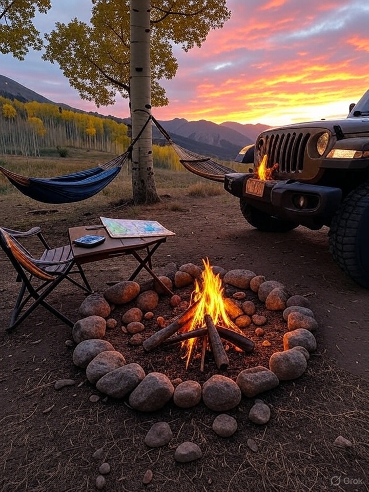
Embarking on an extended wilderness trip can be an exhilarating experience, offering a chance to disconnect from the hustle and bustle of everyday life and reconnect with nature. However, the vastness and unpredictability of the wilderness can pose significant challenges, including the risk of getting lost. To ensure a safe and enjoyable journey, it’s crucial to prepare adequately and employ effective navigation strategies. This essay outlines key steps to prevent getting lost during extended wilderness trips.
Pre-Trip Planning
Research the Area
Researching the area you plan to explore is a foundational step in ensuring a safe and successful wilderness trip. This process involves gathering comprehensive information about the region’s geography, climate, and potential risks. By doing so, you can better prepare for the challenges you might face and enhance your ability to navigate effectively. Here’s a detailed exploration of how to conduct thorough research on your chosen wilderness area:
Study Topographic Maps
Topographic maps are invaluable tools for understanding the physical landscape of an area. They provide detailed information about elevation changes, landforms, and water bodies. When studying these maps:
- Identify Elevation Changes: Look for contour lines to understand the terrain’s elevation. Steep areas will have closely spaced lines, indicating potential challenges in navigation and travel.
- Locate Water Sources: Identify rivers, lakes, and streams, which can serve as both navigation aids and essential resources for hydration.
- Note Trails and Paths: Pay attention to marked trails, noting their difficulty levels and intersections with other paths.
Consult Guidebooks
Guidebooks offer curated insights into specific regions, often written by experienced hikers and explorers. They can provide:
- Trail Descriptions: Detailed accounts of trail conditions, difficulty levels, and estimated travel times.
- Points of Interest: Information about notable landmarks, scenic viewpoints, and historical sites.
- Safety Tips: Advice on avoiding common hazards and dealing with wildlife encounters.
Utilize Online Resources
The internet is a rich source of up-to-date information about wilderness areas. Consider the following:
- Official Park Websites: These sites often provide maps, trail conditions, and alerts about closures or hazards.
- Hiking Forums and Blogs: Engage with communities of hikers who share their experiences, tips, and recent trip reports.
- Satellite Imagery: Use tools like Google Earth to get a bird’s-eye view of the terrain, which can help in visualizing the landscape.
Understand Potential Hazards
Every wilderness area has its unique set of challenges. Research potential hazards such as:
- Wildlife: Learn about the local fauna, including any dangerous animals you might encounter, and how to safely coexist with them.
- Weather Patterns: Study historical weather data to understand seasonal variations and prepare for sudden changes.
- Natural Disasters: Be aware of risks like avalanches, landslides, or flash floods, and know the signs to watch for.
Familiarize with Landmarks and Natural Features
Identifying and understanding natural landmarks can greatly aid in navigation:
- Mountains and Ridges: These can serve as prominent reference points visible from a distance.
- Rock Formations: Unique geological features can help confirm your location on a map.
- Vegetation Zones: Different types of vegetation can indicate changes in elevation or soil conditions.
Engage with Local Experts
If possible, connect with local guides or park rangers who have firsthand knowledge of the area. They can offer invaluable insights and updates on current conditions that might not be available in published resources.
By thoroughly researching the area, you equip yourself with the knowledge needed to navigate confidently and safely. This preparation not only enhances your ability to avoid getting lost but also enriches your overall wilderness experience by allowing you to appreciate the natural beauty and complexity of the environment.
Create a Detailed Itinerary
Creating a detailed itinerary is a crucial step in planning an extended wilderness trip. It serves as a roadmap for your journey, helping you stay organized and focused while also providing a safety net in case of emergencies. A well-crafted itinerary not only guides your daily activities but also ensures that someone knows your whereabouts, which is vital for your safety. Here’s a deeper exploration of how to develop a comprehensive itinerary:
Outline Your Planned Route
Begin by clearly defining the overall route of your trip. This includes:
- Starting and Ending Points: Specify where your journey begins and ends. Include details such as trailheads, parking areas, or access points.
- Daily Segments: Break down your trip into daily segments, outlining the specific trails or paths you plan to take each day.
- Alternate Routes: Identify alternative paths in case of unexpected obstacles like trail closures or severe weather.
Calculate Daily Distances
Accurately estimating the distance you plan to cover each day is essential for pacing yourself and ensuring you reach your destinations safely:
- Measure Distances: Use maps or GPS tools to calculate the distance between key points on your route.
- Consider Terrain: Adjust your daily distance goals based on the difficulty of the terrain. Steeper or more rugged areas may require more time and effort.
- Factor in Rest Days: If your trip is particularly long or strenuous, plan for rest days to recover and enjoy the surroundings.
Estimate Times of Arrival
Having a realistic estimate of when you expect to reach certain points helps in managing time effectively:
- Start Early: Plan to start your days early to maximize daylight hours and allow for unexpected delays.
- Set Milestones: Identify key milestones along your route and estimate arrival times for each. This helps in tracking your progress.
- Account for Breaks: Include time for breaks, meals, and exploration to avoid rushing and ensure you enjoy the experience.
Include Key Details
A comprehensive itinerary should contain additional details that enhance safety and preparedness:
- Campsites and Shelters: List planned campsites or shelters for each night, including backup options if your primary choice is unavailable.
- Water Sources: Identify reliable water sources along your route and plan your water resupply accordingly.
- Emergency Exits: Note any emergency exit points or nearby roads where you can seek help if needed.
Share Your Itinerary
Once your itinerary is complete, share it with a trusted friend or family member:
- Provide Copies: Give them a copy of your itinerary, including maps and contact information for local authorities or park services.
- Set Check-In Times: Arrange specific times to check in with them during your trip, if possible, to confirm your safety and progress.
- Establish a Contingency Plan: Agree on a plan of action if you fail to check in or return as scheduled, such as contacting search and rescue services.
Review and Adjust
Before setting out, review your itinerary to ensure it is realistic and aligns with your fitness level and experience:
- Test Your Gear: Ensure all your equipment is in good working order and suitable for the planned activities.
- Stay Flexible: Be prepared to adjust your itinerary in response to changing conditions or unforeseen circumstances.
By creating a detailed itinerary, you not only enhance your ability to navigate and manage your trip effectively but also provide peace of mind to those who care about your safety. This preparation allows you to focus on enjoying the wilderness experience, knowing that you have a solid plan in place.
Check Weather Conditions
Weather plays a critical role in the success and safety of any wilderness trip. It can affect everything from navigation and travel speed to the overall safety of your journey. Therefore, understanding and preparing for weather conditions is essential. Here’s a detailed exploration of how to effectively check and prepare for weather conditions before and during your wilderness trip:
Monitor Weather Forecasts
Before embarking on your trip, keep a close eye on weather forecasts for the area you plan to explore:
- Use Reliable Sources: Check forecasts from reputable sources such as national meteorological services, local weather stations, or trusted weather apps.
- Look for Patterns: Pay attention to trends in the weather leading up to your trip, such as temperature fluctuations, precipitation levels, and wind conditions.
- Check Multiple Times: Weather can change rapidly, so check forecasts multiple times in the days leading up to your departure.
Understand Seasonal Weather Patterns
Familiarizing yourself with the typical weather patterns for the season in which you’re traveling can help you anticipate potential challenges:
- Temperature Variations: Know the expected temperature range for the time of year, including daytime highs and nighttime lows, to pack appropriate clothing and gear.
- Precipitation Trends: Be aware of the likelihood of rain, snow, or other precipitation, and prepare accordingly with waterproof gear and shelter.
- Wind Conditions: Strong winds can affect navigation and safety, especially in exposed areas like ridges or open plains.
Prepare for Severe Weather
Severe weather can pose significant risks, so it’s crucial to be prepared:
- Identify Shelter Options: Know where you can find shelter along your route in case of severe weather, such as caves, overhangs, or designated shelters.
- Pack Emergency Gear: Carry essential gear for severe weather, including a sturdy tent, extra layers, and emergency blankets.
- Plan for Delays: Severe weather may force you to alter your itinerary or delay your progress, so build flexibility into your schedule.
Adjust Plans as Needed
Be prepared to adjust your plans if the weather forecast indicates severe conditions:
- Postpone or Cancel: If forecasts predict dangerous weather, consider postponing or canceling your trip for safety.
- Modify Your Route: Choose alternative routes that offer more protection from the elements or avoid high-risk areas like river crossings during heavy rain.
- Shorten Your Trip: If necessary, shorten your trip to avoid the worst of the weather or to ensure you can complete your journey safely.
Stay Informed During Your Trip
Once you’re in the wilderness, continue to monitor weather conditions:
- Use a Weather Radio: Carry a portable weather radio to receive updates and alerts while on the trail.
- Observe Natural Signs: Learn to recognize natural indicators of changing weather, such as cloud formations, wind shifts, or sudden temperature drops.
- Communicate with Others: If you encounter other hikers or park rangers, exchange information about weather conditions and any changes you’ve observed.
By thoroughly checking and preparing for weather conditions, you enhance your ability to navigate safely and make informed decisions during your wilderness trip. This preparation not only helps you avoid potential hazards but also ensures that you can enjoy your adventure with confidence and peace of mind.
Essential Navigation Tools
Carry a Map and Compass
In the age of digital navigation tools, the traditional map and compass remain indispensable for wilderness navigation. They are reliable, do not depend on batteries or signals, and can be used in any weather condition. Mastering these tools is crucial for anyone venturing into the wilderness. Here’s a detailed exploration of how to effectively use a map and compass:
Understanding Topographic Maps
Topographic maps provide a detailed representation of the terrain, showing natural and man-made features:
- Contour Lines: These lines indicate elevation and the shape of the land. Closely spaced lines suggest steep terrain, while widely spaced lines indicate flatter areas.
- Symbols and Legends: Familiarize yourself with the symbols used to represent features like trails, water bodies, vegetation, and landmarks. The map legend will explain these symbols.
- Scale and Distance: Understand the map’s scale to accurately measure distances. Use the scale bar to convert map distances to real-world distances.
Choosing the Right Compass
A reliable compass is essential for accurate navigation:
- Baseplate Compass: This type is ideal for map reading, featuring a clear baseplate with a ruler for measuring distances on the map.
- Features to Look For: Ensure your compass has a rotating bezel, a declination adjustment, and a sighting mirror for precise navigation.
Learning to Use a Compass
Mastering compass skills is crucial for effective navigation:
- Orienting the Map: Align the map with the compass so that north on the map matches north on the compass. This helps you visualize the terrain accurately.
- Taking a Bearing: Learn to take a bearing from the map to navigate towards a specific point. Rotate the bezel to align with your destination, then follow the compass needle.
- Adjusting for Declination: Understand magnetic declination, the difference between true north and magnetic north. Adjust your compass accordingly to ensure accurate navigation.
Practicing Map and Compass Skills
Before heading into the wilderness, practice your map and compass skills to build confidence:
- Local Parks or Trails: Practice in familiar areas where you can safely test your skills without the risk of getting lost.
- Orienteering Courses: Participate in orienteering events or courses to improve your navigation skills in a controlled environment.
- Simulated Scenarios: Create scenarios where you must navigate to specific points using only your map and compass.
Integrating Map and Compass Use
Combine map and compass skills for effective navigation:
- Triangulation: Use triangulation to determine your exact location by taking bearings to two or more known landmarks.
- Route Planning: Plan your route by identifying key landmarks and features on the map, then use your compass to navigate between them.
- Regular Checks: Frequently check your position on the map and adjust your course as needed to stay on track.
Preparing for the Trip
Ensure you are fully prepared to use your map and compass during your trip:
- Waterproofing: Protect your map with a waterproof case or laminate it to prevent damage from moisture.
- Backup Copies: Carry a backup map in case the original is lost or damaged.
- Compass Maintenance: Check your compass for any damage or inaccuracies before setting out.
By carrying and mastering the use of a map and compass, you equip yourself with the skills needed to navigate confidently and safely in the wilderness. These tools provide a reliable means of orientation, ensuring you can find your way even when electronic devices fail.
Use a GPS Device
A GPS device is a powerful tool that can significantly enhance your navigation capabilities during wilderness trips. While traditional tools like maps and compasses are essential, a GPS device offers real-time location data and can simplify route finding. However, it’s important to understand its functions, limitations, and how to integrate it effectively with other navigation methods. Here’s a detailed exploration of using a GPS device in the wilderness:
Understanding GPS Technology
GPS (Global Positioning System) devices use signals from satellites to determine your precise location on Earth:
- Satellite Connectivity: GPS devices connect to a network of satellites orbiting the Earth to triangulate your position.
- Accuracy: Most modern GPS devices offer accuracy within a few meters, though this can vary based on environmental conditions.
Choosing the Right GPS Device
Selecting a suitable GPS device is crucial for effective navigation:
- Handheld GPS Units: These are designed for outdoor use, offering durability, weather resistance, and features tailored for hiking and exploration.
- Smartphone Apps: Many smartphones have GPS capabilities and can run navigation apps, but they may lack the durability and battery life of dedicated devices.
- Wearable GPS: Devices like GPS watches offer convenience and portability, though they may have limited features compared to handheld units.
Preparing Your GPS Device
Before setting out, ensure your GPS device is ready for the trip:
- Fully Charge the Device: Start with a fully charged battery and carry spare batteries or a portable charger to ensure continuous operation.
- Preload Maps: Download and store maps of the area you’ll be exploring, as GPS devices may not have internet access in remote locations.
- Update Software: Ensure your device’s software is up-to-date to benefit from the latest features and improvements.
Familiarizing Yourself with GPS Functions
Understanding how to use your GPS device effectively is key to maximizing its benefits:
- Waypoints: Learn to set waypoints, which are specific locations you can mark and return to, such as campsites or trailheads.
- Track Logs: Use track logs to record your path, allowing you to retrace your steps if needed.
- Route Planning: Plan routes in advance and load them onto your device, enabling you to follow a pre-determined path.
Recognizing GPS Limitations
While GPS devices are highly useful, they have limitations that users should be aware of:
- Signal Interference: Dense forests, deep valleys, and urban canyons can obstruct satellite signals, reducing accuracy or causing signal loss.
- Battery Life: GPS devices can consume significant power, especially when using features like backlighting or continuous tracking.
- Environmental Conditions: Extreme weather conditions, such as heavy rain or snow, can affect device performance.
Integrating GPS with Traditional Navigation
For the best results, use your GPS device in conjunction with traditional navigation tools:
- Cross-Verification: Regularly cross-check your GPS data with a map and compass to ensure accuracy and maintain situational awareness.
- Backup Plan: Always have a backup navigation plan in case your GPS device fails or runs out of power.
- Skill Development: Practice using both GPS and traditional tools to build confidence and proficiency in various navigation scenarios.
Safety and Efficiency
Using a GPS device can enhance both safety and efficiency during your trip:
- Emergency Situations: In emergencies, a GPS can help you quickly determine your location and communicate it to rescuers.
- Time Management: Efficient navigation with a GPS can save time, allowing you to focus on enjoying the wilderness experience.
By effectively using a GPS device, you can enhance your navigation capabilities and increase your confidence in exploring unfamiliar terrain. However, it’s essential to understand its limitations and integrate it with traditional navigation methods to ensure a safe and successful wilderness adventure.
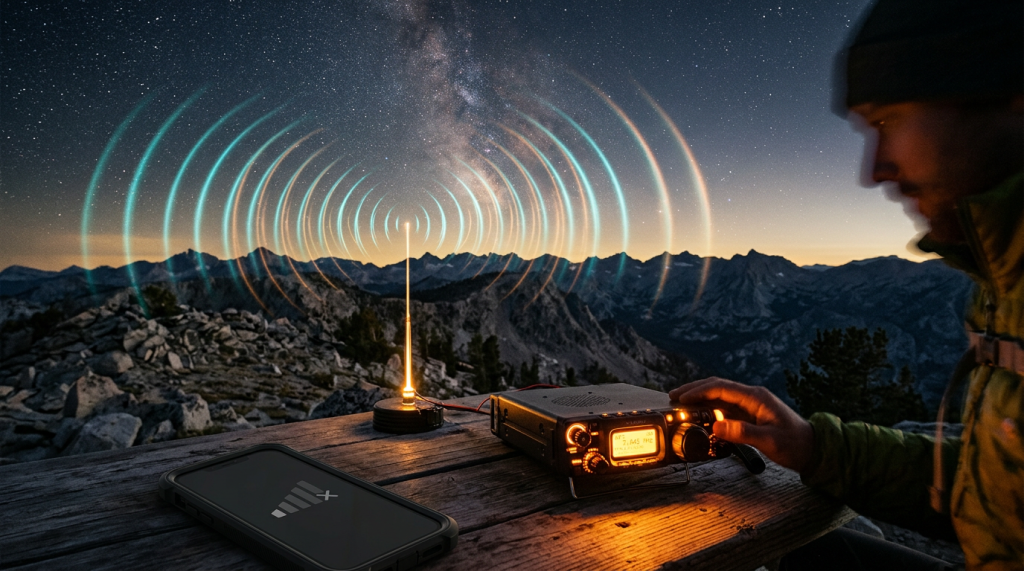
Consider a Personal Locator Beacon (PLB)
A Personal Locator Beacon (PLB) is a critical safety device for anyone venturing into remote or wilderness areas. While it does not assist with navigation, a PLB can be a lifesaver in emergencies by sending a distress signal to alert rescue services of your location. Understanding how to use a PLB effectively is essential for ensuring your safety during wilderness trips. Here’s a detailed exploration of PLBs and their importance:
Understanding PLBs
PLBs are designed to transmit a distress signal to emergency services via satellite:
- Satellite Communication: PLBs use satellite networks, such as the COSPAS-SARSAT system, to send distress signals. This system is monitored globally, ensuring that your signal can be received anywhere in the world.
- Signal Transmission: When activated, a PLB sends a signal that includes your unique identifier and GPS coordinates, allowing rescuers to locate you quickly.
Choosing the Right PLB
Selecting a suitable PLB involves considering several factors:
- Size and Weight: PLBs are compact and lightweight, making them easy to carry in a backpack or attach to your gear.
- Battery Life: Ensure the PLB has a long battery life, typically lasting several years in standby mode. Check the expiration date and replace the battery as needed.
- Waterproof and Durable: Choose a PLB that is waterproof and rugged enough to withstand harsh outdoor conditions.
Registering Your PLB
Before using a PLB, it’s crucial to register it with the appropriate authorities:
- Registration Process: Register your PLB with the national authority responsible for managing distress signals, such as NOAA in the United States. This process involves providing your contact information and trip details.
- Updating Information: Keep your registration information up-to-date, including emergency contacts and any changes to your travel plans.
Activating a PLB
Knowing how to activate your PLB correctly is vital in an emergency:
- Activation Procedure: Familiarize yourself with the activation process, which typically involves deploying an antenna and pressing a button. Follow the manufacturer’s instructions carefully.
- When to Activate: Use your PLB only in life-threatening situations where immediate rescue is necessary. Activating it unnecessarily can divert resources from genuine emergencies.
Limitations of PLBs
While PLBs are highly effective, they have some limitations:
- One-Way Communication: PLBs send signals but do not receive messages, meaning you won’t receive confirmation that your signal was received.
- No Navigation Assistance: PLBs do not provide navigation capabilities, so they should be used alongside other navigation tools.
Integrating PLBs into Your Safety Plan
Incorporate a PLB into your overall safety strategy for wilderness trips:
- Emergency Preparedness: Include a PLB as part of your emergency kit, along with other essentials like a first-aid kit, whistle, and flashlight.
- Communication Plan: Inform your emergency contacts about your PLB and its registration details, so they know what to expect if it’s activated.
- Practice Activation: Practice the activation process in a controlled environment to ensure you can do it quickly and correctly under stress.
Peace of Mind
Carrying a PLB provides peace of mind, knowing that help is just a signal away in case of an emergency. It reassures both you and your loved ones that you have a reliable means of summoning assistance if needed.
By considering and carrying a Personal Locator Beacon, you enhance your safety during wilderness adventures. While it’s not a substitute for careful planning and navigation skills, a PLB is an invaluable tool for ensuring that you can get help when it matters most.
Combining the functionalities of a GPS device and a Personal Locator Beacon (PLB) into a single device, such as the Garmin GPSMAP 67i, offers a comprehensive solution for wilderness navigation and safety. Devices like the GPSMAP 67i integrate GPS navigation capabilities with satellite communication features, allowing users to not only track their location and plan routes but also send distress signals and communicate with emergency services via satellite networks like Iridium. This dual functionality provides the convenience of having both navigation and emergency communication in one compact device, reducing the need to carry multiple gadgets. Additionally, these devices often include features like two-way messaging, weather updates, and route sharing, enhancing both safety and connectivity in remote areas. By using a combined GPS and PLB device, adventurers can enjoy the peace of mind that comes with knowing they have reliable navigation tools and a direct line to emergency assistance, all in one package.
On-the-Ground Navigation Strategies
Stay on Marked Trails
Staying on marked trails is one of the most effective strategies for ensuring safety and minimizing the risk of getting lost during wilderness trips. Marked trails are designed to guide hikers through natural areas while minimizing environmental impact and preserving the integrity of the ecosystem. Here’s a detailed exploration of why sticking to marked trails is important and how to safely navigate them:
Benefits of Staying on Marked Trails
Marked trails offer several advantages that enhance both safety and the overall hiking experience:
- Clear Navigation: Trails are often well-marked with signs, blazes, or cairns, making it easier to follow the intended path without the need for constant map checks.
- Maintenance and Safety: Established trails are regularly maintained to ensure they are safe and passable, reducing the risk of encountering unexpected obstacles like fallen trees or eroded sections.
- Environmental Protection: By staying on designated paths, hikers help protect fragile ecosystems and minimize their impact on wildlife and plant life.
Understanding Trail Markings
Familiarize yourself with the various types of trail markings you may encounter:
- Blazes: Painted marks on trees or rocks that indicate the trail direction. Different colors or shapes may denote different trails.
- Signs: Informational signs at trailheads and intersections provide details about trail names, distances, and difficulty levels.
- Cairns: Stacked rocks used to mark trails in areas where vegetation is sparse, such as alpine or desert environments.
Planning Your Route on Marked Trails
Before setting out, plan your route using marked trails:
- Trail Maps: Use trail maps to identify the best routes for your skill level and interests. Pay attention to trail length, elevation changes, and points of interest.
- Trail Conditions: Check for any updates on trail conditions, closures, or maintenance work that might affect your plans.
- Trail Etiquette: Follow trail etiquette by yielding to other hikers, staying on the path, and packing out all trash.
Venturing Off-Trail
While staying on marked trails is recommended, there may be times when you need to venture off-trail:
- Assess the Need: Only go off-trail if necessary, such as to avoid an obstacle or reach a specific destination not accessible by marked paths.
- Use Caution: Move slowly and carefully, being mindful of your surroundings and potential hazards like loose rocks or unstable ground.
- Regular Position Checks: Frequently check your position on the map and use a compass or GPS to ensure you maintain your intended direction.
Safety Considerations
Prioritize safety when navigating marked trails:
- Stay Alert: Pay attention to trail markers and signs to avoid accidentally straying from the path.
- Travel in Groups: Whenever possible, hike with others to enhance safety and provide assistance if needed.
- Emergency Plan: Have a plan in place for emergencies, including knowing how to contact help and having a basic first-aid kit.
Environmental Responsibility
Respect the natural environment by adhering to Leave No Trace principles:
- Stay on the Trail: Avoid creating new paths or widening existing trails, which can lead to erosion and habitat destruction.
- Respect Wildlife: Observe animals from a distance and do not disturb their natural behaviors or habitats.
By staying on marked trails, hikers can enjoy a safer and more environmentally responsible wilderness experience. These trails provide a reliable guide through natural landscapes, allowing adventurers to focus on the beauty and serenity of the outdoors while minimizing risks and preserving the environment for future generations.
Use Natural Landmarks
Natural landmarks are invaluable tools for navigation in the wilderness. They provide reliable reference points that can help you maintain your orientation and ensure you stay on course. By learning to identify and use these features effectively, you can enhance your ability to navigate without relying solely on maps or electronic devices. Here’s a detailed exploration of how to use natural landmarks for navigation:
Identifying Natural Landmarks
Natural landmarks are prominent features in the landscape that are easily recognizable and can be used for orientation:
- Mountains and Peaks: These are often visible from great distances and can serve as fixed points to help you determine your direction.
- Ridges and Valleys: The contours of ridges and valleys can guide your path, as they often run in consistent directions.
- Rivers and Streams: Waterways can be followed to reach specific destinations or used as boundaries to prevent straying too far off course.
- Rock Formations: Unique or unusual rock formations can act as distinctive markers that are easy to spot and remember.
Using Landmarks for Orientation
Once you’ve identified natural landmarks, use them to maintain your sense of direction:
- Triangulation: Use two or more landmarks to triangulate your position. By taking bearings to these landmarks, you can pinpoint your location on a map.
- Line of Sight: Keep a landmark in your line of sight as you travel. This helps you maintain a consistent direction and provides a reference point if you need to backtrack.
- Landmark Sequencing: Plan your route by moving from one landmark to the next, creating a sequence that guides your journey.
Navigating with Landmarks
Incorporate natural landmarks into your navigation strategy:
- Route Planning: Before setting out, identify key landmarks along your intended route and mark them on your map. This helps you visualize your path and anticipate changes in direction.
- Backtracking: If you become disoriented, use landmarks to retrace your steps. Return to the last known landmark and reassess your position and direction.
- Distance Estimation: Use landmarks to estimate distances. For example, if a mountain is a known distance away, you can gauge your progress by observing how its appearance changes as you approach.
Challenges and Considerations
While natural landmarks are useful, there are challenges to consider:
- Visibility: Weather conditions such as fog, rain, or snow can obscure landmarks, making them difficult to see. Be prepared to rely on other navigation methods in such conditions.
- Changing Landscapes: Seasonal changes or natural events like landslides can alter the appearance of landmarks, so stay adaptable and verify your position regularly.
- Human-Made Structures: In some areas, human-made structures like towers or buildings can also serve as landmarks, but they may not be as reliable as natural features in remote areas.
Enhancing Your Skills
Develop your ability to use natural landmarks through practice and observation:
- Field Practice: Spend time in various environments practicing landmark-based navigation. Start in familiar areas and gradually move to more challenging terrains.
- Observation Skills: Enhance your ability to notice and remember details about landmarks, such as their shape, size, and relative position to other features.
- Map Integration: Regularly compare your observations with your map to reinforce your understanding of the landscape and improve your ability to navigate using landmarks.
By effectively using natural landmarks, you can navigate the wilderness with greater confidence and independence. These features provide a reliable means of orientation, helping you maintain your course and enjoy the beauty of the natural world without the constant need for technological aids.
Regularly Check Your Position
Regularly checking your position is a fundamental practice in wilderness navigation that helps ensure you remain on course and avoid getting lost. By consistently comparing your current location with your map and surroundings, you can quickly detect any deviations from your planned route and make necessary adjustments. Here’s a detailed exploration of how to effectively check your position during a wilderness trip:
Importance of Regular Position Checks
Frequent position checks are crucial for several reasons:
- Early Detection of Errors: By regularly verifying your location, you can identify and correct navigational errors before they lead you significantly off course.
- Increased Situational Awareness: Understanding your position relative to your surroundings enhances your overall situational awareness, helping you make informed decisions.
- Confidence Building: Regular checks reinforce your confidence in your navigation skills and reduce anxiety about getting lost.
Techniques for Checking Your Position
There are several techniques you can use to check your position effectively:
- Map and Compass: Use your map and compass to determine your current location. Identify nearby landmarks on the map and align them with your surroundings.
- GPS Device: If you have a GPS device, use it to confirm your coordinates and compare them with your planned route on the map.
- Natural Landmarks: Use natural landmarks to verify your position. Cross-reference these features with your map to ensure you are where you expect to be.
Steps for Effective Position Checking
Follow these steps to ensure accurate and effective position checks:
- Stop and Observe: Pause regularly to observe your surroundings and identify key features such as hills, rivers, or distinct rock formations.
- Map Alignment: Orient your map to match the landscape. This involves aligning the map’s north with true north using a compass.
- Identify Landmarks: Locate visible landmarks on both the map and in the environment. Use these to triangulate your position if necessary.
- Check Bearings: Take compass bearings to known landmarks and compare them with the map to confirm your direction and location.
- Record Your Position: Note your position on the map, especially at key points like trail intersections or significant landmarks.
Frequency of Position Checks
The frequency of position checks depends on several factors:
- Terrain Complexity: In complex or featureless terrain, check your position more frequently to avoid disorientation.
- Visibility Conditions: In poor visibility conditions, such as fog or heavy forest cover, increase the frequency of checks to maintain orientation.
- Route Familiarity: On unfamiliar routes, conduct more frequent checks to ensure you remain on the correct path.
Challenges and Solutions
While checking your position is essential, there are challenges to consider:
- Time Consumption: Frequent checks can slow your progress. Balance the need for accuracy with the desire to maintain a steady pace.
- Environmental Conditions: Adverse weather or dense vegetation can make it difficult to see landmarks. In such cases, rely more on compass bearings and GPS data.
- Map Reading Skills: Ensure you are proficient in map reading to accurately interpret the terrain and features.
Enhancing Your Skills
Improve your ability to check your position through practice and experience:
- Practice in Familiar Areas: Start by practicing position checks in familiar areas to build confidence and proficiency.
- Simulate Scenarios: Create scenarios where you must determine your position without relying on technology, enhancing your traditional navigation skills.
- Continuous Learning: Continuously refine your skills by learning from experienced navigators and participating in navigation courses or workshops.
By regularly checking your position, you can navigate the wilderness with greater accuracy and confidence. This practice helps you stay on track, avoid potential hazards, and fully enjoy the adventure of exploring the natural world.
Emergency Preparedness
Pack an Emergency Kit
An emergency kit is a vital component of any wilderness trip, providing essential tools and supplies that can be crucial in unexpected situations. Whether you encounter adverse weather, become lost, or face an injury, a well-prepared emergency kit can make a significant difference in your safety and comfort. Here’s a detailed exploration of what to include in your emergency kit and how to use it effectively:
Essential Components of an Emergency Kit
A comprehensive emergency kit should include the following items:
- Whistle: A whistle is a simple yet effective tool for signaling for help. Its sound can carry over long distances, making it easier for rescuers to locate you.
- Signal Mirror: A signal mirror can be used to reflect sunlight and attract attention from rescuers or passing aircraft. It’s especially useful in open areas where sound may not travel as far.
- Flashlight: A reliable flashlight or headlamp is essential for visibility in low-light conditions. Choose one with a long battery life and carry spare batteries.
- Extra Food and Water: Pack non-perishable, high-energy snacks like energy bars, nuts, or dried fruit. Carry extra water or a portable water filter to ensure you stay hydrated.
- First-Aid Kit: A basic first-aid kit should include bandages, antiseptic wipes, pain relievers, tweezers, and any personal medications. Tailor the kit to your specific needs and the length of your trip.
Additional Items to Consider
Depending on the environment and duration of your trip, consider including these additional items:
- Fire-Starting Tools: Waterproof matches, a lighter, and fire starters can help you build a fire for warmth, cooking, or signaling.
- Emergency Blanket: A lightweight, reflective emergency blanket can provide warmth and protection from the elements.
- Multi-Tool or Knife: A multi-tool or knife is versatile for various tasks, from preparing food to making repairs.
- Map and Compass: Even if you have a GPS device, a map and compass are essential backups for navigation.
- Rain Gear and Extra Clothing: Pack a poncho or rain jacket and extra layers to stay dry and warm in changing weather conditions.
Organizing and Maintaining Your Kit
Proper organization and maintenance of your emergency kit are crucial for its effectiveness:
- Waterproof Container: Store your emergency kit in a waterproof bag or container to protect it from moisture and damage.
- Regular Checks: Periodically check your kit to ensure all items are in good condition and replace any expired or used supplies.
- Accessibility: Keep your emergency kit easily accessible in your backpack so you can quickly reach it in an urgent situation.
Using Your Emergency Kit Effectively
Knowing how to use the items in your emergency kit is as important as having them:
- Practice Skills: Familiarize yourself with using each item, such as starting a fire or administering first aid, before your trip.
- Stay Calm: In an emergency, remain calm and assess the situation. Use your kit to address immediate needs and signal for help.
- Conserve Resources: Use your supplies wisely, especially food and water, to ensure they last until help arrives or you reach safety.
Tailoring Your Kit to Your Trip
Customize your emergency kit based on the specific conditions and challenges of your trip:
- Environment-Specific Items: Consider additional items like insect repellent for buggy areas or snow goggles for winter conditions.
- Group Size: Adjust the quantity of supplies based on the number of people in your group.
By packing a well-equipped emergency kit, you enhance your preparedness for unexpected situations in the wilderness. This proactive approach not only increases your safety but also provides peace of mind, allowing you to focus on enjoying your adventure with confidence.
Know Basic Survival Skills
Having a solid foundation in basic survival skills is essential for anyone venturing into the wilderness. These skills can be lifesaving in emergencies, helping you maintain safety and comfort while waiting for rescue or finding your way back to civilization. Here’s a detailed exploration of key survival skills and how to develop them:
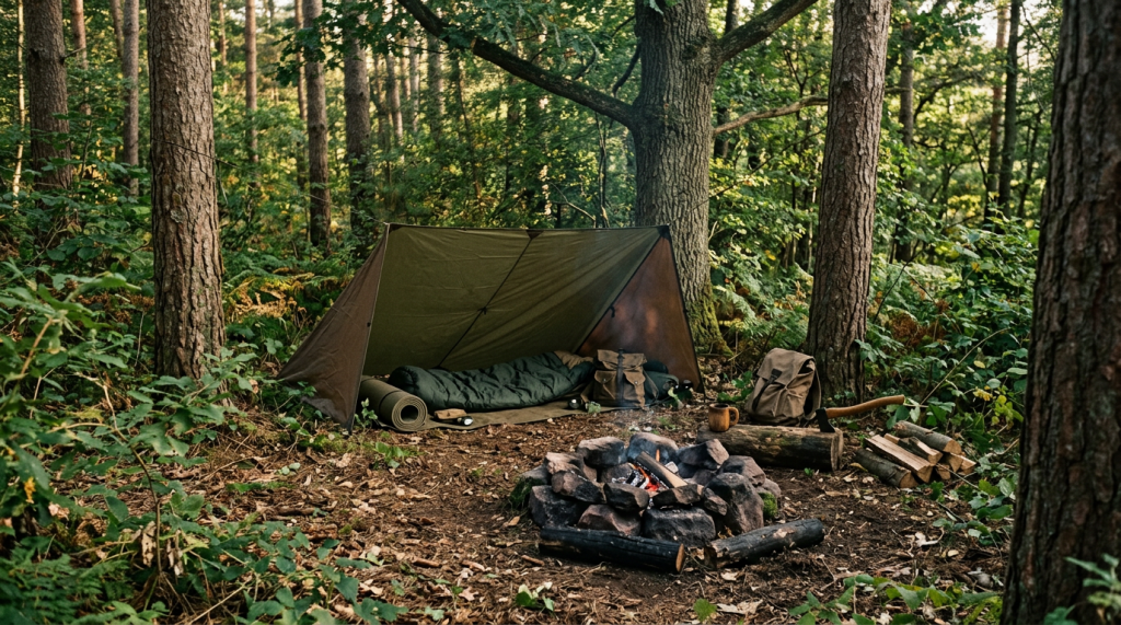
Building a Shelter
A well-constructed shelter provides protection from the elements, helping to maintain body temperature and prevent hypothermia:
- Types of Shelters: Learn to build different types of shelters based on available materials and environmental conditions, such as debris huts, lean-tos, or snow caves.
- Site Selection: Choose a location that is safe from hazards like falling branches, flooding, or strong winds. Look for natural windbreaks and avoid low-lying areas prone to water accumulation.
- Construction Techniques: Use natural materials like branches, leaves, and snow to construct your shelter. Ensure it is insulated and weatherproof, with a small entrance to retain heat.
Starting a Fire
Fire is crucial for warmth, cooking, and signaling for help:
- Fire-Starting Methods: Familiarize yourself with various fire-starting techniques, such as using matches, lighters, fire starters, or friction-based methods like bow drills.
- Gathering Materials: Collect dry tinder, kindling, and fuel wood. Look for materials like dry grass, bark, and small twigs to start the fire, and larger logs to sustain it.
- Fire Safety: Build your fire in a safe location, away from flammable materials and sheltered from the wind. Always have a means to extinguish the fire, such as water or soil, and ensure it is completely out before leaving.
Finding Safe Drinking Water
Access to safe drinking water is vital for survival:
- Water Sources: Identify potential water sources such as streams, rivers, lakes, or rainwater. Be cautious of stagnant water, which may be contaminated.
- Purification Methods: Learn to purify water using methods like boiling, chemical treatments (e.g., iodine or chlorine tablets), or filtration systems. Boiling is the most reliable method to kill pathogens.
- Conservation: Conserve water by drinking only when necessary and avoiding strenuous activity during the hottest parts of the day to reduce dehydration.
Additional Survival Skills
Beyond shelter, fire, and water, other survival skills can enhance your ability to cope in the wilderness:
- Navigation: Develop skills in map reading, compass use, and natural navigation techniques, such as using the sun or stars to find direction.
- Foraging: Learn to identify edible plants and insects, but exercise caution and avoid consuming anything unless you are certain it is safe.
- Signaling for Help: Use signals like smoke, mirrors, or whistles to attract attention. Create visible markers, such as SOS signs, in open areas.
Developing and Practicing Survival Skills
To effectively use these skills in an emergency, practice and preparation are key:
- Hands-On Training: Participate in survival courses or workshops to gain hands-on experience and guidance from experts.
- Simulated Scenarios: Practice survival skills in controlled environments, simulating real-life scenarios to build confidence and proficiency.
- Continuous Learning: Stay informed about new techniques and technologies in wilderness survival, and regularly refresh your skills.
By familiarizing yourself with basic survival skills, you equip yourself with the knowledge and confidence needed to handle unexpected situations in the wilderness. These skills not only increase your chances of survival but also enhance your overall outdoor experience by fostering a deeper connection with the natural environment.
Stay Calm and Think Clearly
Finding yourself lost in the wilderness can be a daunting experience, but maintaining composure is crucial for making sound decisions and ensuring your safety. Panic can lead to hasty actions and poor judgment, which may exacerbate the situation. By staying calm and following a structured approach, you can effectively assess your situation and take appropriate steps to find your way back. Here’s a detailed exploration of how to stay calm and think clearly when lost:
The STOP Acronym
The STOP acronym is a helpful guide for managing the situation when you realize you’re lost:
- Stop: Immediately stop moving. Continuing to wander aimlessly can lead you further off course and increase the risk of injury or exhaustion.
- Think: Take a moment to collect your thoughts. Reflect on your last known location and any landmarks or features you’ve passed. Consider the time of day and weather conditions.
- Observe: Assess your surroundings carefully. Look for recognizable landmarks, trail markers, or signs of human activity. Listen for sounds that might indicate nearby roads or water sources.
- Plan: Develop a plan based on your observations. Decide whether to stay put and wait for rescue or attempt to retrace your steps or find a known location.
Techniques for Staying Calm
Maintaining a calm demeanor is essential for clear thinking:
- Breathing Exercises: Practice deep breathing to reduce anxiety and lower your heart rate. Inhale slowly through your nose, hold for a few seconds, and exhale through your mouth.
- Positive Self-Talk: Reassure yourself with positive affirmations. Remind yourself of your skills, preparation, and the resources you have at your disposal.
- Focus on the Present: Concentrate on immediate tasks and decisions rather than worrying about potential outcomes.
Retracing Your Steps
If you decide to retrace your steps, do so methodically:
- Backtrack Carefully: Follow your path back to the last point where you were confident of your location. Look for familiar landmarks or trail markers.
- Mark Your Path: As you backtrack, mark your path with natural indicators like sticks or stones to avoid getting further disoriented.
- Use Navigation Tools: Utilize your map, compass, or GPS device to confirm your direction and ensure you’re heading the right way.
Using Navigation Tools
Leverage your navigation tools to determine your location:
- Map and Compass: Identify your position using landmarks and compass bearings. Cross-reference these with your map to pinpoint your location.
- GPS Device: If available, use your GPS to check your coordinates and compare them with your planned route.
- Natural Navigation: Use the sun, stars, or natural features like rivers to orient yourself if other tools are unavailable.
Deciding to Stay Put
In some situations, staying put may be the best option:
- Signal for Help: Create visible signals like a large SOS sign or use a whistle or mirror to attract attention.
- Conserve Resources: Ration your food and water, and use your emergency kit to maintain warmth and safety.
- Prepare for Rescue: Make yourself visible to searchers by staying in open areas and maintaining a fire or bright clothing.
Learning from the Experience
After resolving the situation, reflect on the experience to improve future preparedness:
- Analyze the Situation: Consider what led to becoming lost and how you can prevent similar situations in the future.
- Skill Development: Identify any skills or knowledge gaps and seek opportunities for further training or practice.
- Share Your Story: Share your experience with others to raise awareness and help them learn from your situation.
By staying calm and thinking clearly, you can effectively manage the challenges of being lost in the wilderness. This approach not only increases your chances of a safe resolution but also builds resilience and confidence for future adventures.
Conclusion
Embarking on an extended wilderness trip offers a unique opportunity to connect with nature and experience the beauty of the great outdoors. However, the vastness and unpredictability of wilderness areas also present challenges, particularly the risk of getting lost. To mitigate this risk and ensure a safe and enjoyable adventure, thorough preparation, the right tools, and effective navigation strategies are essential. Here’s a detailed exploration of how these elements come together to enhance your wilderness experience:
Thorough Preparation
Preparation is the cornerstone of a successful wilderness trip. It involves several key steps:
- Research the Area: Understanding the terrain, climate, and potential hazards of your destination is crucial. This knowledge allows you to anticipate challenges and plan your route effectively. Familiarize yourself with local wildlife, vegetation, and weather patterns to make informed decisions during your trip.
- Create a Detailed Itinerary: A well-thought-out itinerary outlines your planned route, daily distances, and estimated times of arrival. Sharing this itinerary with a trusted contact ensures someone knows your whereabouts and can alert authorities if necessary.
- Check Weather Conditions: Monitoring weather forecasts and understanding seasonal patterns help you prepare for environmental conditions and adjust your plans accordingly.
Carrying Essential Equipment
Having the right equipment is vital for navigation and safety:
- Map and Compass: These traditional tools are indispensable for navigation. Mastering their use ensures you can find your way even when electronic devices fail.
- GPS Device and PLB: Modern technology, such as GPS devices and Personal Locator Beacons (PLBs), provides additional support. A GPS offers real-time location data, while a PLB can send distress signals in emergencies.
- Emergency Kit: A well-stocked emergency kit, including items like a whistle, flashlight, and first-aid supplies, prepares you for unexpected situations.
Effective Navigation Strategies
Employing effective navigation strategies minimizes the risk of getting lost:
- Stay on Marked Trails: Following established paths reduces the likelihood of disorientation and protects the environment.
- Use Natural Landmarks: Identifying and using natural features like mountains and rivers helps maintain orientation and provides reference points.
- Regularly Check Your Position: Frequent position checks ensure you remain on course and can quickly correct any deviations.
Staying Vigilant
Vigilance is key to adapting to changing conditions and making informed decisions:
- Stay Calm and Think Clearly: In challenging situations, maintaining composure allows you to assess your options and choose the best course of action.
- Know Basic Survival Skills: Skills such as building a shelter, starting a fire, and finding water enhance your ability to cope with unexpected challenges.
Enjoying a Safe and Memorable Adventure
By integrating thorough preparation, essential equipment, and effective navigation strategies, you create a solid foundation for a safe and memorable wilderness adventure. This approach not only minimizes the risk of getting lost but also enhances your overall experience by allowing you to focus on the beauty and tranquility of the natural world. With the right mindset and skills, you can confidently explore the wilderness, knowing you are well-equipped to handle whatever challenges may arise.


Leave a Reply